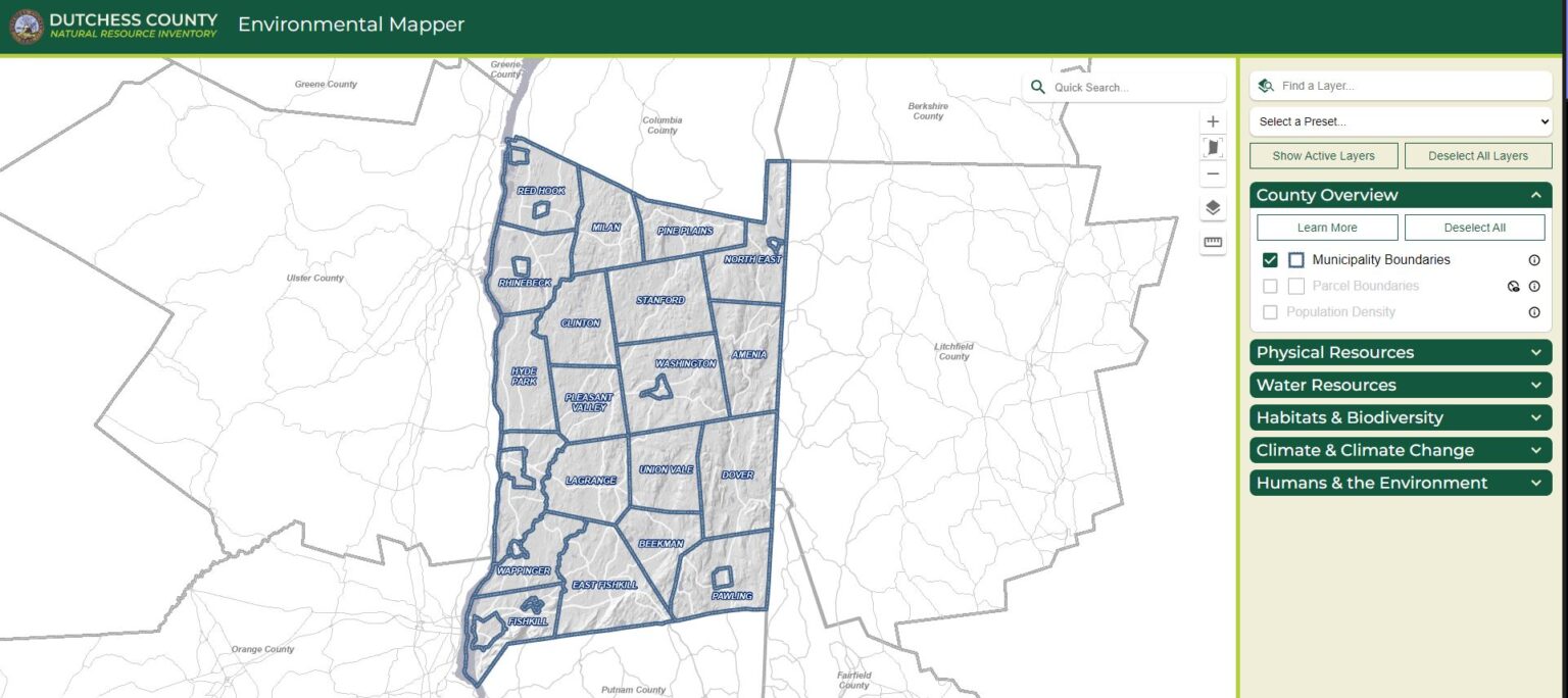
County Overview & Municipalities
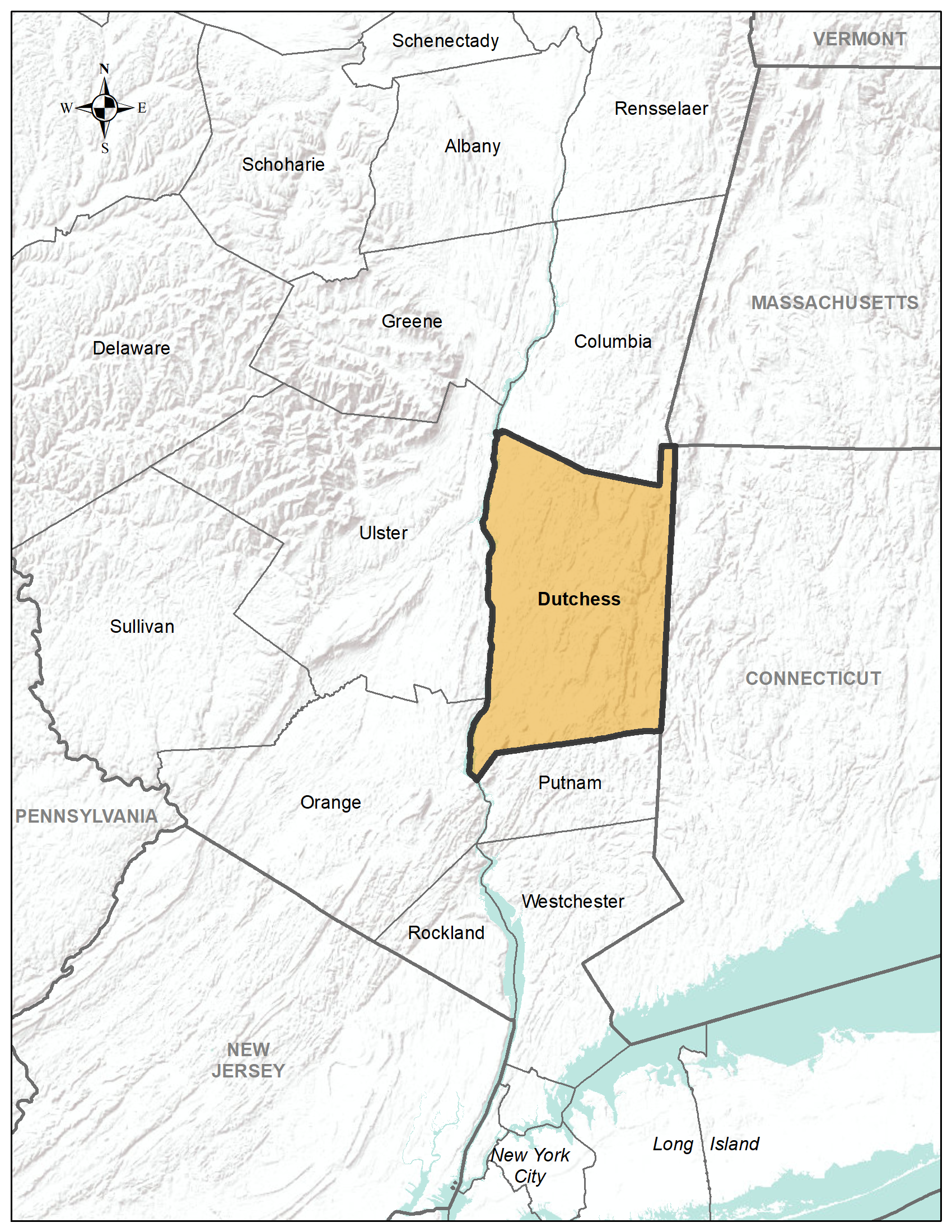
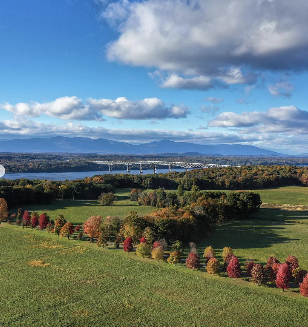
Dutchess County is centrally located within the Hudson Valley region in southeastern New York state and is bordered by Connecticut to the east, Putnam County to the south, Columbia County to the north, and Orange and Ulster Counties across the Hudson River to the west (Figure 1.1). It covers approximately 801.6 square miles, including 20 square miles of the Hudson River.
Dutchess County is comprised of 30 municipalities: 20 towns, two cities, and eight villages (Figure 1.2). The county seat is the City of Poughkeepsie, located on the shore of the Hudson River. Poughkeepsie is approximately equidistant from Albany and New York City.
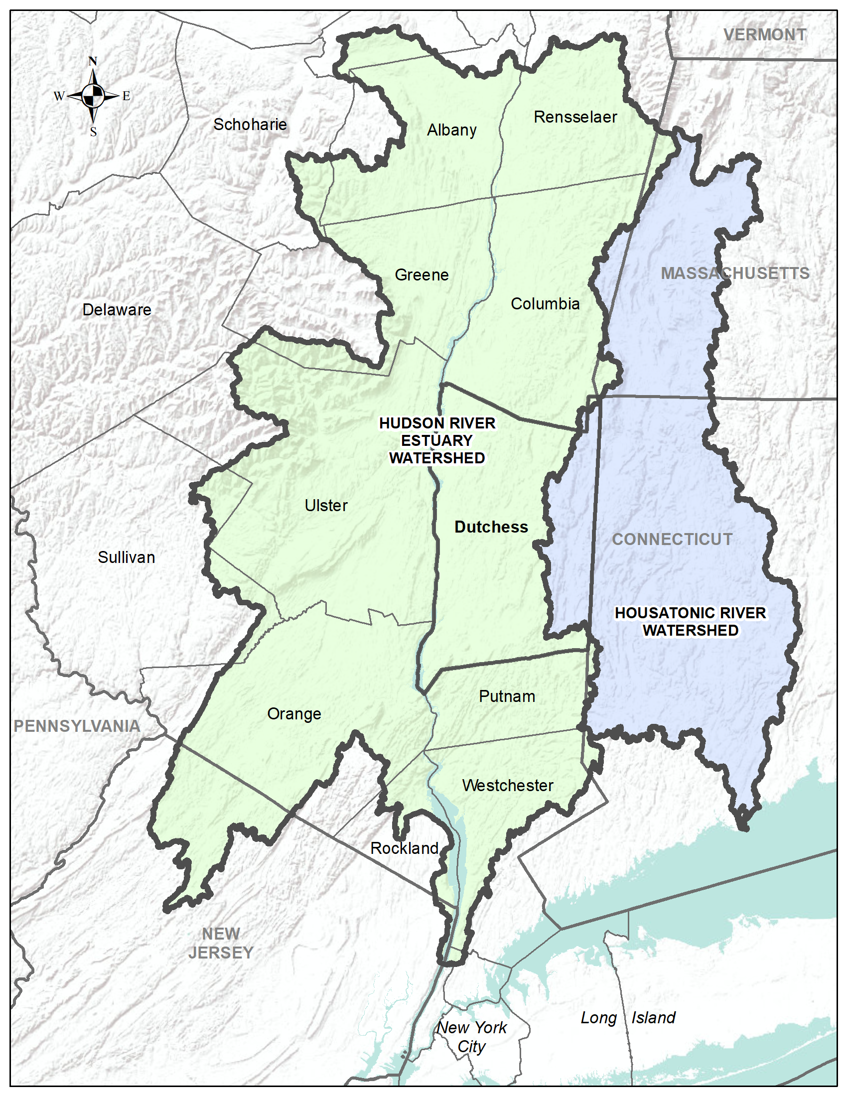
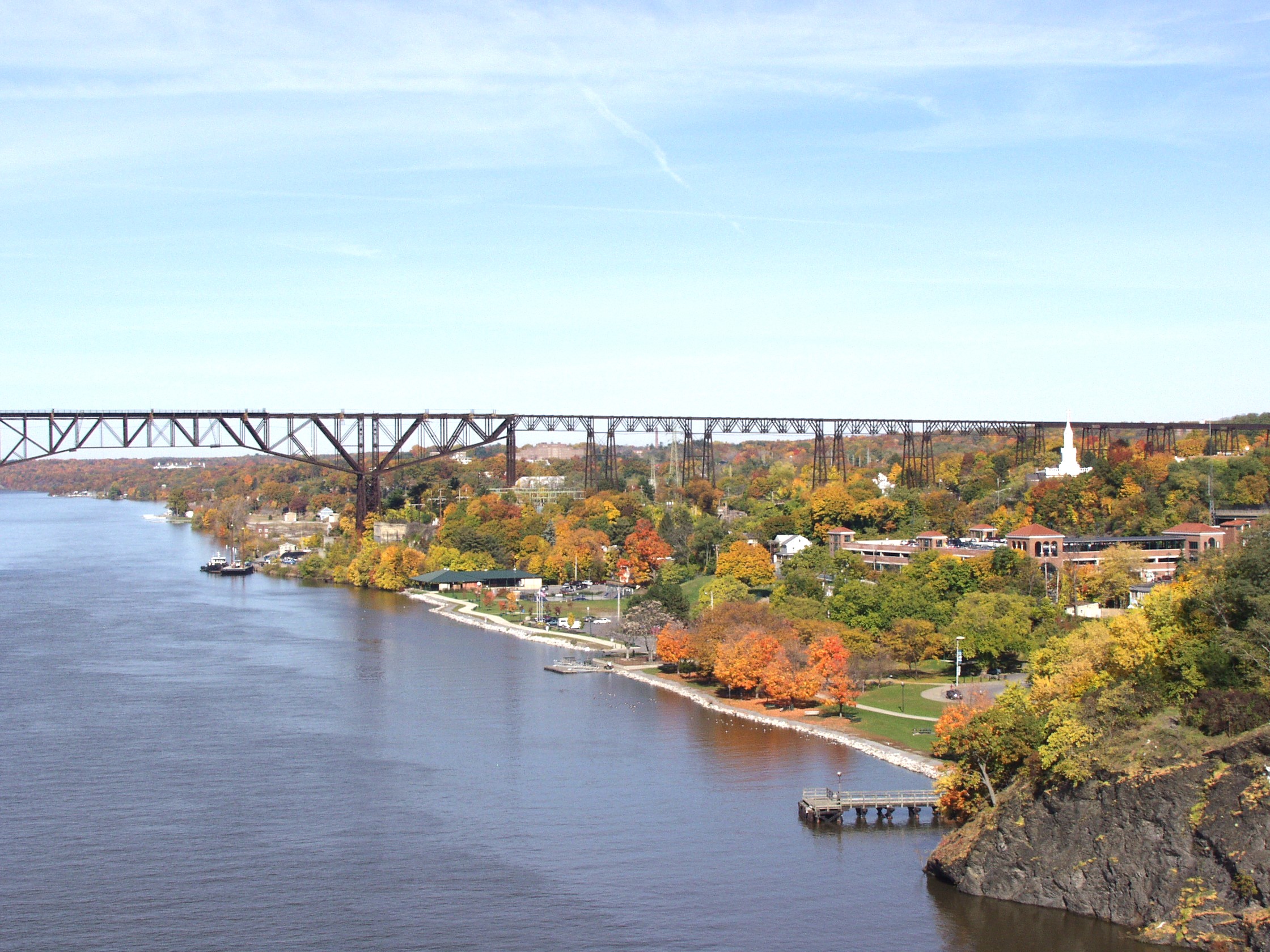
The Hudson River is the "defining natural feature" of this region of New York State, and Dutchess County mostly falls within the watershed of the Hudson River Estuary, which extends 153 miles from Troy to New York Harbor (Figure 1.3) [4]. The Hudson River Estuary is the estuary that incorporates the Hudson River and is home to unique plant and animal communities that have adapted to brackish water — a mixture of fresh water draining from the land and salty seawater.
The eastern portion of the county lies in the Tenmile River watershed, which is part of the Housatonic River watershed in Connecticut (for more information, see the Water Resources section of this inventory.)

Population & Population Centers

During the 2020 census, Dutchess County’s population was 295,911. [1] The population of the county had undergone a tremendous increase over the 20th century and into the early 21st century, up until this most recent census period (2020) when the county saw its first population decrease since 1890. [1] Most of the county’s residents live along the Hudson River, the Route 9, Route 44, and Route 55 corridors, or in pockets of more dense settlements such as village hamlets (Figure 1.3).
Approximately 75 percent of the population of the county lives in the southwest region, including the cities of Beacon and Poughkeepsie, the villages of Fishkill and Wappingers Falls, and the towns of Beekman, East Fishkill, Fishkill, LaGrange, Poughkeepsie, and Wappinger (Table 1.1). Several municipalities in Dutchess County have seen increasing urban and suburban development over time due to population growth and conventional development strategies.
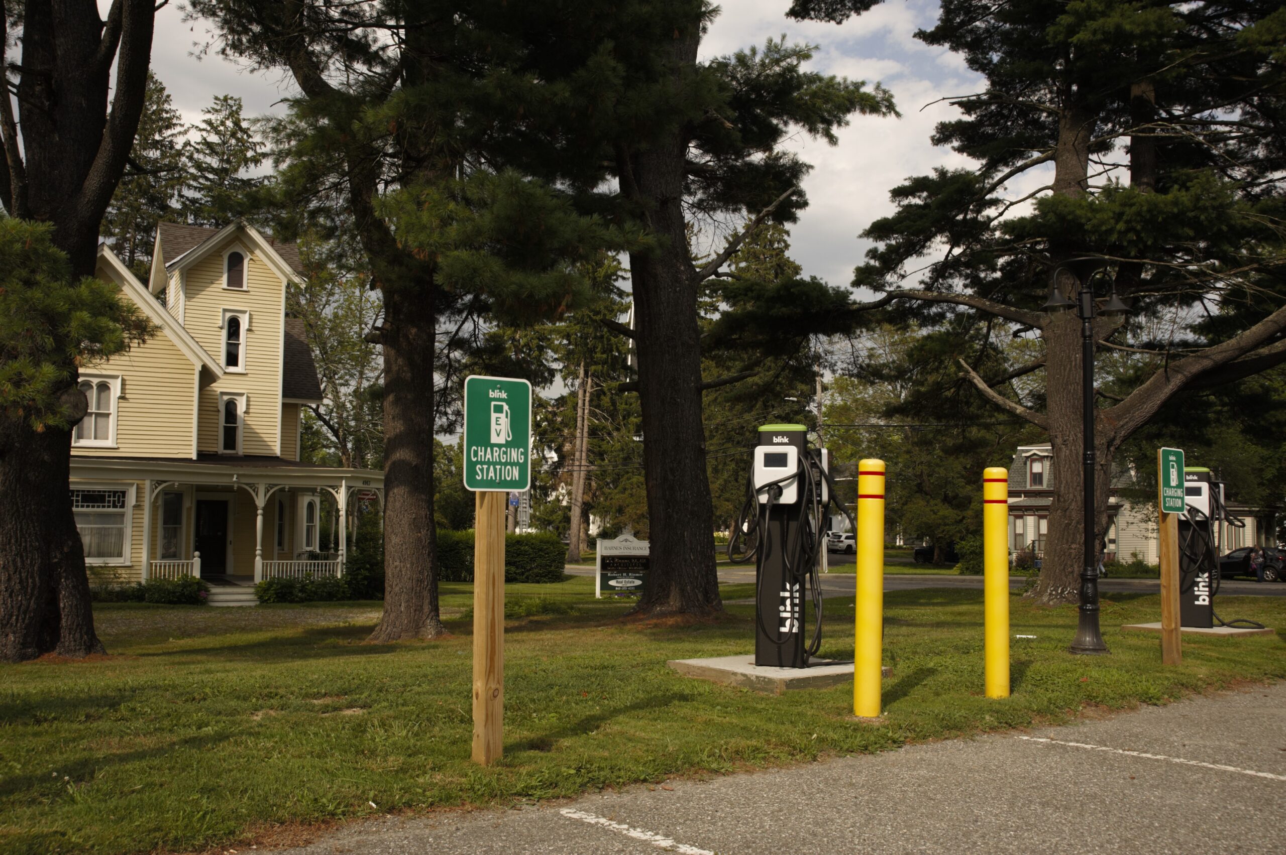
Dutchess County has also seen substantial changes in land use. Aerial photographs of Dutchess County from the 1930s show that majority of land was used for farming, with small hamlets and town centers (Figure 1.3). [2] Since the 1950s there has been a large shift from agriculture to suburban development, as many former farm fields have been sub-divided for use as housing and commercial developments. [2] Most recently, development has continued in the suburban centers in the southwestern portion of the county (Beacon, Fishkill, East Fishkill, Wappinger, LaGrange, and Poughkeepsie), as well as along the Route 9, Route 44, and Route 52 corridors.

A Brief History of Dutchess County
When Henry Hudson sailed up the Hudson River in 1609, laying claim to the valley for the Dutch Crown, the east bank of the river had been home for centuries to the Wappinger Indians and other members of the Algonquin Federation. They called one of their encampments Poughkeepsie, “the reed-covered lodge by the little water place." In 1683, the colonial assembly established the twelve original counties of New York. Dutchess was among them, named after Mary of Modena, then Duchess of York and wife of the future King James II of England. The county's name derives from the seventeenth-century spelling of "duchess," as preserved in the original November 1, 1683, law that established the first twelve counties of New York.
Early European settlements clustered along the Hudson River at modern Beacon, Fishkill, Poughkeepsie, Rhinebeck, and Red Hook. Colonists from New England founded communities throughout the disputed areas of eastern Dutchess in the opening decades of the eighteenth century. The Treaty of Dover of 1731 stabilized the border zone.
Until the American Revolution, much of Dutchess County was organized into large land patents owned by a few rich men, including the Rombout Patent, the Beekman Patent, and the Nine Partners Patent. These owners subsequently sold lots or rented out allotments to tenants, leading to fraught relations that presaged the American independence movement. Later, during the Revolutionary War, the Village of Fishkill hosted the primary supply depot for the entire Northern Department of the Continental Army, including barracks, a hospital, and workshops. After the burning of Kingston in October 1777, Poughkeepsie served as the state capitol until the conclusion of hostilities.
Through June and July 1788, the Dutchess County Courthouse at Poughkeepsie provided the scene for New York’s Ratification Debates on the United States Constitution. Celebrated luminaries including Alexander Hamilton, John Jay, and New York Governor George Clinton argued alongside local notables like Melancton Smith. Smith, the one-time sheriff of Dutchess County, is credited with throwing the vote in favor of ratification by introducing the idea for what would become the Bill of Rights.
During the post-Revolutionary era, the county began a slow climb to economic prosperity. In 1785, New York State granted the first license for the Post Road, formally establishing a series of taverns and inns along modern Route 9, some of which still stand today. These include the Elmendorph Inn at Red Hook and the Beekman Arms in Rhinebeck. The road network continued to grow throughout the nineteenth century, eventually being eclipsed by the railroad, which reached Poughkeepsie in the 1830s. The combination of highways, railroads, and river access transformed western Dutchess into an industrial powerhouse, while strengthening agriculture in eastern Dutchess. Construction of the Borden Milk Company’s headquarters at Wassaic in Amenia insured the long prominence of the dairy industry in that region.
Ease of access and economic prosperity brought the first families of America from New York City to found or expand estates along the Hudson River. The Astors, Rogers, and Vanderbilts were among the families whose vast and beautiful properties dotted the landscape along the river and in the eastern highlands. As this leisure class with money and time to pursue learning and culture emerged, literary and historical societies, schools, and institutions of higher learning emerged. From Vassar College to small community libraries, learning thrived in Dutchess County from the second quarter of the nineteenth century onwards.
Landscape painters Frederick Church and Thomas Cole gained fame and patronage as the Hudson River School flourished, while landscape architects including Andrew Jackson Downing and Calvert Vaux selected Dutchess County as the canvass for several remarkable projects, including Springside in Poughkeepsie.
Early in the twentieth century, Dutchess County regained political prominence as the home of Franklin Delano Roosevelt. During his service as governor and subsequently as President of the United States, Roosevelt and his wife Eleanor made Dutchess an experimental laboratory for New Deal ideas. FDR was the only President to win a fourth term in the White House; when Thomas E. Dewey from Pawling ran against him in 1944, it was the only time in American history when two men from the same county vied for the Presidency.
The seeds for post-World War II prosperity in Dutchess were planted in 1942 when IBM purchased property in Poughkeepsie. The expansion of their operations in the 1950s and 1960s introduced an era of tremendous growth in the Information Technology field and further transformed the county landscape. A growing population, with accompanying expansions of suburbs, required new roads and increased engagement from county government.
In 1967, Dutchess voters passed a county charter that created the Office of the County Executive and the Dutchess County legislature to provide dedicated service for county-wide needs. In recent years, county government has acted to preserve historical elements of the landscape through adaptive re-use, nomination of sites to the National Register of Historic Places, and the development of entire historic districts. In consideration of Dutchess’ predominantly rural character, county government has assisted in the creation of agricultural districts preserving more than 200,000 acres of farmland.
Dutchess County's history is visible at every turn. Colonial homesteads, gothic cottages, clapboard farmhouses, Victorian villas, Beaux Arts mansions, stone churches, country inns — all stand in silent witness to past lives and events that have shaped the distinctive character of Dutchess County. High-tech industries and modern shopping malls have replaced brickyards and trading posts.
Today, Dutchess County remains rooted in a deep history that in many ways has grown from the abundant natural resources the Hudson Valley provides, and without which modern communities could never have flourished. Updating a natural resources inventory helps communities develop a comprehension of where their natural and cultural resources are located, and which resources are significant to a community. The compilation of maps, data, and descriptions within an NRI contributes to a better understanding and appreciation of the community’s natural resources and provides the foundation for a wide range of planning and conservation applications. In particular, the inventory provides the building blocks for land-use and conservation planning and serves as a tool for natural resource information to be included in local planning and zoning.
Additional Resources
References
[2] DCDPD, 2000
[3] https://www.dutchessny.gov/Departments/History/A-Brief-History-of-Dutchess-County.htm
[4] https://dec.ny.gov/nature/waterbodies/oceans-estuaries/hudson-estuary
Glossary
Hudson River Estuary: An estuary is a partially enclosed coastal body of brackish water with one or more rivers or streams flowing into it, and with a free connection to the open sea. The Hudson River Estuary is the estuary that includes the portion of the Hudson River south of the Troy dam and is home to unique plant and animal communities that have adapted to brackish water – a mixture of fresh water draining from the land and salty seawater.
Post Road: Often historic, a post road is a route or road which was built so that post riders or mail coaches could carry mail from place to place.
Watershed: A land area that channels rainfall and snowmelt to creeks, streams, and rivers, and eventually to outflow points such as reservoirs, bays, and the ocean.