
Habitats & Biodiversity
Situated in the mid-Hudson River Valley, at a biological crossroads between species and habitats of the surrounding regions, Dutchess County contains a rich diversity of habitats [1]. Biodiversity plays a critical role in the many benefits natural habitats provide, and because New York is a home-rule state, it is our local governments, planners, and developers, who are tasked with protecting this important characteristic. In the Hudson Valley, approximately 85% of the land and water resources that we value are controlled by private landowners and local municipalities [1]. This high percentage showcases the importance of local planning and management and the immense potential it has to protecting biodiversity.
The concept of biodiversity can be defined as the entire diversity of genetic variety, species, and ecosystems in a given region [2]. Biodiversity includes plants, animals, fungi, and microorganisms, although we give most attention to the larger plants and animals. Conserving these organisms and the systems they occupy requires some familiarity with the current state of the resources, both rare and common.
Biodiversity is a complex idea that often gets oversimplified. People understand biodiversity, as the number and variety of living things in a given area. While this certainly is true, the full concept of biodiversity goes much deeper, to include the variability among all living organisms and among the ecological complexes of which they are part. This includes diversity between species, within species, between ecosystems, and among their functional role in that ecosystem [2]. This definition touches on the traditional view of species richness, or number of individual species, but elaborates on it to include the importance of diversity in habitats, ecosystem services or functions, and ecological relationships and interactions.
The Value of Biodiversity
Conserving and protecting our natural areas and resources has innumerable benefits. Intact and diverse habitats and ecosystems provide us not only with beautiful areas for recreational purposes but also countless ecosystem services and functions that are critical for healthy, safe, and thriving communities. While there are numerous benefits that we receive from healthy, intact, and biodiverse ecosystems, this NRI webpage will serve to highlight a number of these that are most relevant in Dutchess County.
Dutchess County Biodiversity Overview
Situated in the mid-Hudson Valley, at a biological crossroads between species and habitats of the surrounding regions, Dutchess County contains a rich diversity of habitats [1]. Even within the larger New York State region, the Hudson Valley is high in overall biodviersity, with important and unique habitats tucked away in all corners. These habitats support species that are rare in more densely settled regions, from river otters and black bears to pileated woodpeckers, woodland warblers, and specialized wetland orchids and sedges. The county supports several federally listed threatened species, including the Blanding’s turtle and the Indiana bat. Many residents might be surprised to learn about the level of diversity that can be found in what we often consider a suburban county. Further below, we review the county’s key habitat types, distribution of ecological regions, and factors that influence the biological diversity of our area.
Biodiversity conservation in Dutchess County requires collaboration of private landowners and local decision makers. Over 85 percent of the county is privately owned, and many important habitat areas in the county occur on private lands. For example, most known locations of the Northern cricket frog (a state listed endangered species) in the county are on privately owned land [3]. Populations such as these have often been viewed as obstacles to development but protecting them can also help protect the landscapes and habitats that make our area distinctive.
Conservation is most effective when communities can identify important biological resources and develop conservation priorities before target species become threatened. Planning can help communities save time and money in land use disputes, in debates between land developers and planning and zoning boards, or even in legal action over conservation of legally protected species and their habitats.
The goals of this NRI webpage are: 1) to guide municipal officials and residents toward identifying biodiversity resources in their communities, and 2) to provide resources to aid local governments, landowners, and communities in identifying priorities for biodiversity conservation.
Benefits of Habitat Conservation
Habitat conservation can entail protecting key spots of special value, or it can mean maintaining open space with minimal development or clustered development. “Green space” is another term often used for vegetated open space. Both green space and open space may be actively used, for example, in farming, pasture, or forestry, and often these actively managed areas can provide useful habitat for a variety of flora and fauna. Thus, the ideas of “open space” and “habitat” can overlap considerably. Certainly, habitat conservation is generally impossible without open space conservation.
Conserving open space can provide a variety of economic benefits. Protecting open space, as outlined in Dutchess County’s “Centers and Green Spaces” plans, can support the local farm economy while conserving woodlands and open fields [4]. Wetland and floodplain conservation can help reduce the impact of flooding and also protect groundwater resources. The aesthetic amenity of open space enhances property values, and biodiversity contributes to regional income from recreation and tourism. These and other benefits have been outlined by the Hudson River Valley Greenway Compact [5].
Significant Biodiversity Area (SBA) Descriptions
In 2006, the New York State Department of Environmental Conservation (NYSDEC), the New York Cooperative Fish & Wildlife Unit at Cornell University, and the New York Natural Heritage Program partners together to identify and map Significant Biodiversity Areas (SBAs) for the Hudson River Estuary Watershed region, of which Dutchess County is a part [6]. The product of this effort is a critical tool for conservation planning, the Wildlife and Habitat Conservation Framework, which categorized and described regional SBAs. SBAs are large-scale landscape areas that contain high concentrations of biodiversity or unique ecological features. These areas often contribute to and serve as a framework for conservation partnerships and voluntary protection efforts.
Within Dutchess County there are six identified SBAS (Table 1), with the largest being the “Dutchess County Wetlands” Significant Biodiversity Area, spread across ten towns mostly in the western and central parts of the county. In the eastern part of the county is another large and important Significant Biodiversity Area, the “Harlem Valley Calcareous Wetlands” SBA [6]. While SBAs account for much of the range in regional biodiversity throughout the watershed, they should not be interpreted as the only important areas for biodiversity.
Signficant Biodiversity Areas:- Dutchess County Wetlands
- Harlem Valley Calcareous Wetlands
- Taconic Ridge
- Hudson Highlands
- Hudson River Estuary & Tidal Wetlands (Mid-Hudson River)
- Hudson River Estuary & Tidal Wetlands (Upper-Hudson River)
Dutchess County Wetlands
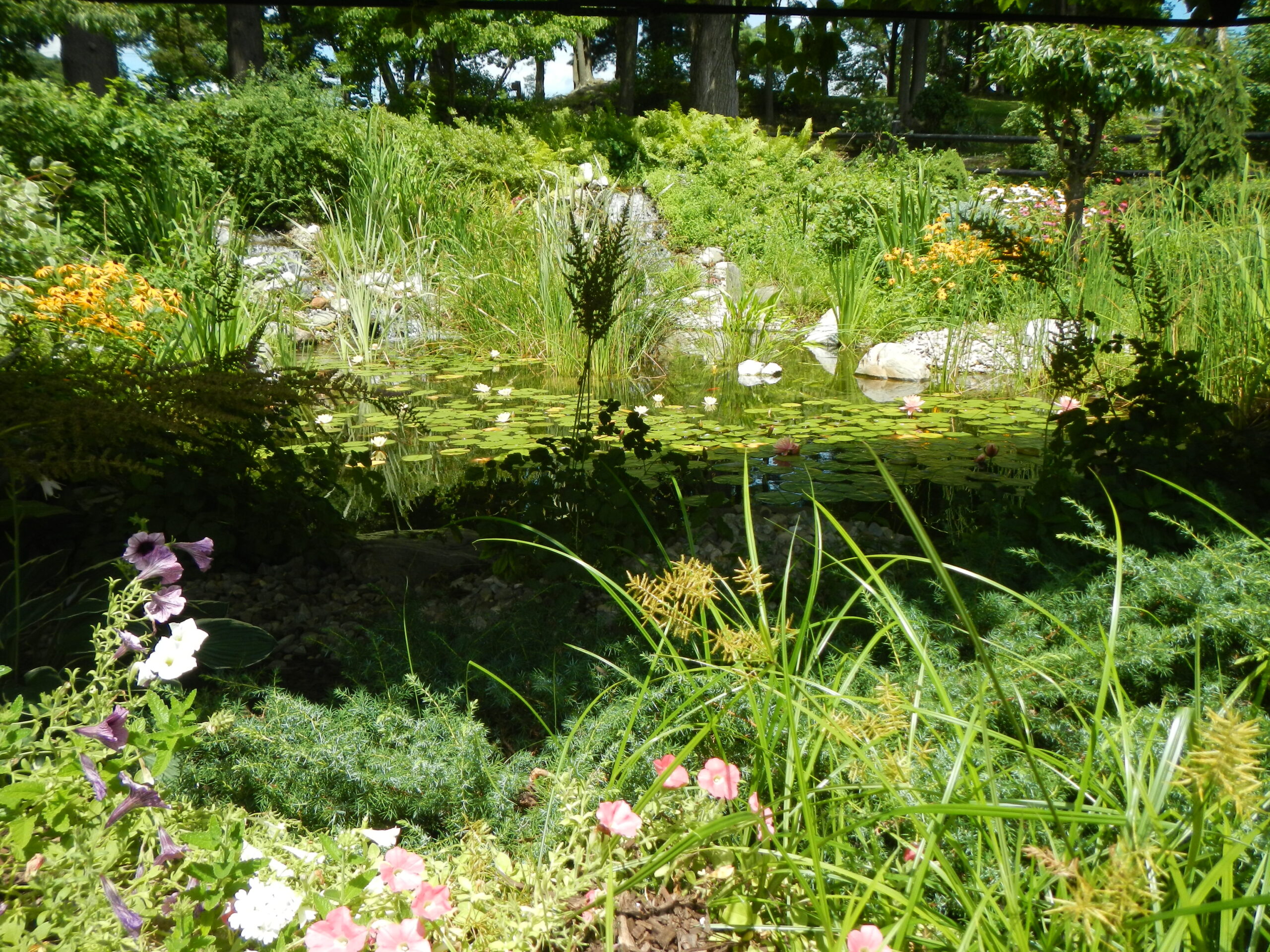
The Dutchess County Wetlands area is a network of four major wetland complexes that provide important habitat for a variety of amphibian, reptile, and bird species. This area contains the highest diversity of turtles in New York State. The significant area encompasses several wetlands and their watersheds, and wetland buffer zones that are biologically significant for breeding waterfowl, rare turtles, plants, and other species, as well as intervening areas that contain potential habitat for these species. Floodplain forest communities also exist within this area.
The four separate wetland complexes total 66,000 acres. Two of the complexes (Milan Window and Stissing Mountain sites) feed Wappinger Creek, which then flows along the eastern edge of Poughkeepsie and through Wappinger Falls before flowing into the Hudson River. The southernmost complex (La Grange/East Fishkill site) contains wetlands that flow into Fishkill Creek, which flows through Beacon and then directly into the Hudson River about 8 miles after leaving the area. The East Park/Hyde Park site encompasses most of Crum Elbow Creek, from its beginning near Wurtemburg to approximately half a mile from the Hudson River.
The Dutchess County Wetlands SBA falls mostly in the lowlands of the Hudson River Watershed and consist mainly of soft sedimentary rocks that are easily eroded and with relatively little topography. These lowlands tend to facilitate slow moving water and extensive wetland formation. Some of the Dutchess County Wetland sites, particularly Stissing Mountain, are part of the Taconic ranges more resistant metamorphic rocks. The high variety in rock types helps support a high diversity of flora and fauna.
The wetlands occur in western Dutchess County from Interstate 84 north to the Dutchess-Columbia County line. The SBA can be found within the towns of Beekman, Clinton, East Fishkill, Fishkill, Hyde Park, La Grange, Milan, Pine Plains, Pleasant Valley, Rhinebeck, Stanford, and Wappinger. This area is similar to the USFWS Dutchess County Wetlands Significant Habitat Complex. The four wetland complexes included within this area are, from south to north: La Grange/East Fishkill, East Park/Hyde Park, Milan Window, and Stissing Mountain.
Dutchess County is made up of wetland complexes with many habitats that are unusual or scarce in the region. In addition to being valuable in their own right, these wetlands support a number of local populations of the state listed threatened Blanding’s turtle, one of the few sites for this species in the northeastern United States. These wetlands also support the state-endangered bog turtle. Other rare reptile and amphibian species in this area include the state listed northern cricket frog (the only known occurrence of this species east of the Hudson River), and the regionally rare blue-spotted salamander, marbled salamander, four toed salamander, spotted turtle, wood turtle, eastern box turtle, red-bellied snake, and eastern ribbon snake. The only documented consistent overwintering by golden eagles in the region occurs in this area. Additionally, pied-billed grebe nesting sites and great blue heron rookeries have been documented in the area. The extensive complex of diverse wetlands and upland forests include rich red maple hardwood swamps containing the state rare swamp cottonwood, floodplain forest, deep emergent marsh, rich sloping fen, and medium fen communities. Other rare plant species include prairie sedge and the state listed rare smartweed dodder.
Conservation Issues and Recommendations:Suburban expansion, along with runoff from nearby roads, agricultural lands, and developed areas, pose the most serious threats to this wetland ecosystem. Further study of the distribution, population status, habitat use, and movement patterns of the bog and Blanding’s turtles, and other species, is needed. Protection of wetlands and their buffer zones, as well as of the movement corridors and road crossings between wetlands, is the highest priority. Additional inventory is greatly needed, especially with respect to amphibians and reptiles, and mapping of habitat complexes for the Blanding’s turtle.
Harlem Valley Calcareous WetlandsThe Harlem Valley Calcareous Wetlands are composed of the valleys and adjacent ridges in the Taconic Highlands. Wetland communities include red maple-hardwood swamp, floodplain forest, fens, and shallow emergent marsh. These areas contain high quality habitat for a number of wetland-dependent species and some of the best bog turtle habitat in the Hudson River Valley. This area also includes adjacent upland ridge and ledge habitat that is especially important for northern copperhead, timber rattlesnake, and five lined skink. The area is made up of two separate wetland complexes totaling 94,000 acres. Both complexes occur in the valleys and adjacent ridges of the southern Taconic Highlands. The Northeast-Ancram fen complex occurs in Columbia and Dutchess Counties (the northern complex). The portion within the Hudson River Estuary Watershed includes wetlands drained by Punch Brook Swamp, the Noster Kill, and the Roeliff Jansen Kill. The Great Swamp area (the southern complex) is in Dutchess and Putnam Counties. The portion within the Hudson River Estuary Watershed includes the headwaters of the Croton River and the “South Flow” of the Great Swamp. The portion in the Connecticut River Watershed includes the “North Flow” of the Great Swamp and the headwaters of the Housatonic River.
The majority of the Harlem Valley Calcareous Wetlands biodiversity area consists of Stockbridge Marble, a metamorphic rock composed of the minerals calcite or dolomite. It is formed when limestone is treated to very high temperature and pressure, such as the Taconics’ mountain forming process. Because of the proximity of this area to the Taconic Mountains, other bedrock components of the area are also mostly metamorphosed rocks (e.g., gneiss, schist, and to a lesser extent, quartzite). These materials are more resistant to erosion than their non-metamorphosed relatives, however their basic (non-acidic) composition maintains wetlands high in strong>pH. Interestingly, because of the nearby Taconic Mountains and the convoluted nature of the bedrock (many layers, wide ranges in metamorphism), water upwellings and springs are common in this region. The result is a preponderance of communities dependent on freshwater upwellings of high pH water, namely fens. Other calcareous regions (Hudson Valley Limestone and Shale Ridges, Dutchess County Wetlands, Esopus Lloyd Wetlands) have much fewer occurrences of fen communities than the Harlem Valley Calcareous Wetlands biodiversity area. Most of the surficial geology deposits are of glacial origin, such as till, kame deposits, and outwash sand and gravel. Other deposits, such as those in the wetlands, consist of more recent alluvium and organic deposits.
Wetland matrix communities consist of red maple-hardwood swamp and floodplain forest. The upland matrix community tends to be Appalachian oak-hickory forest. Patch communities include inland Atlantic white cedar swamp, red maple-tamarack peat swamp, rich graminoid fen, rich shrub fen, rich sloping fen, and shallow emergent marsh. Upland patch communities include pitch pine-oak-heath rocky summit, rocky summit grassland, and hemlock-northern hardwood forest.
This area is within the easternmost portion of Dutchess County. Two separate wetland complexes are recognized: the ‘Great Swamp’ from Brewster (Putnam County) north to Amenia, and the ‘Northeast Ancram fen complex’ from Sharon, CT north to Copake Falls (Columbia County). The lowlands occupy a long north-south valley west of the Taconic Mountains called the Harlem Valley (after the railroad line) from which this complex takes its name. Within Dutchess County, this SBA can be found in the towns of Amenia, Dover, North East, Pawling, Pine Plains, Washington, and the villages of Millerton and Pawling. This area is similar to the USFWS Harlem Valley Calcareous Wetlands Significant Habitat Complex. The Great Swamp follows the ridgetops that form the immediate watershed of the wetlands. Great Swamp habitat area includes the wetlands of the Harlem Valley adjacent and proximate to the East Branch of the Croton River, Swamp River, and Ten Mile River; marble hills emerging from the floor of the Harlem Valley; and mountainous slopes on the east and west sides of the Harlem Valley. There is a drainage divide between the Hudson River and the Housatonic River Watersheds at the village of Pawling where the East Branch of the Croton River flows to the south into the Hudson and the Swamp River flows to the north into the Housatonic Watershed. Although the watersheds are separate, the swamp itself is continuous over both watersheds.
The site encompasses the calcareous wetlands and uplands and ridgetop habitat that support rare reptiles, waterfowl, and raptors, as well as rare plant habitats and communities. The mosaic of calcareous wetlands and adjacent uplands in the Harlem Valley supports regionally significant rare reptile populations and rare calcareous communities and plant species. These calcareous wetlands have truly exceptional concentrations of rare elements. The significant area is considered to contain the best bog turtle habitat in this Hudson Valley region. Three additional fens within the area were recently found to contain the state endangered (federally listed threatened) bog turtle (Howard et al. 2002). In all, 26 occurrences of bog turtle have been recorded for the Harlem Valley Calcareous Wetlands biodiversity area. This area also contains 11 hibernacula for the state-threatened timber rattlesnake. Other rare animals recorded include Eastern pondmussel and upland sandpiper. Recently, The Nature Conservancy purchased a very significant rich sloping fen with a bog turtle population, increasing protection of the bog turtles, fen communities, and rare plants present there.
Some of the fens and fen like areas of the site also support regionally rare plants. Great Swamp has several rare calcareous communities and plants. In addition to timber rattlesnake populations, the ledges, talus, acidic rocky crest savannas, woodlands, burn areas, and associated habitats also support northern copperhead and five lined skink. The area supports several regionally rare species such as bladderwort, three toothed cinquefoil, and the dogwood thyatirid moth. The deeper marshes and some of the ponds in this area are important habitats for waterfowl and marsh birds. The extensive wooded swamps support breeding red shouldered hawk and concentrations of migrating warblers. Also notable in the region is an extensive, old growth, hardwoods floodplain savanna with huge ashes and maples, unlike anything else in the region.
Conservation Issues and Recommendations:Suburban expansion and invasive species are the two central conservation issues in this area. Further study and field surveys of the distribution, population status, habitat use, and movement patterns of the bog turtle, in particular, and other species are needed throughout the entire complex of calcareous wetlands in the tri state region. Protection of wetlands, their buffer zones, and movement corridors connecting wetlands, is a high priority. These efforts should help direct suburban development to less sensitive areas.
Taconic RidgeThe Taconic Ridge encompasses large areas of contiguous, high quality, northern hardwood forest underlain by complex metamorphic bedrock. It serves as a principal watershed and recharge area for numerous rich fens and associated rare plant and animal species. The Taconic Ridge extends nearly 60 miles along the eastern edge of New York State and is about 12 miles wide at its widest point. Within New York, it covers approximately 78,700 acres. Running along the divide between the Hudson and Connecticut River Watersheds, 53,600 acres of this area fall within the Hudson River Watershed.
Hemlock-northern hardwood forest and Appalachian oak-hickory forest are the most common matrix forest types. Patch communities include pitch pine-oak-heath rocky summit, acidic talus slope wetland, and rocky summit grassland.
The Taconics contain high topographic variability that enhances diversity of community types and associated species. About 450 million years ago (the Ordovician Period), colliding continents caused the formation of a mountain chain the size of the Himalayas in eastern New York and western New England. These mountains have eroded to what is now the Taconic Range. The bedrock geology consists of various types of metamorphic rocks; mainly deformed sedimentary rocks that were pushed up from the ocean floor from the advancing continent. These bedrock formations have less buffering capabilities against acid rain and other pollutants than the limestone-rich areas of the Hudson River Estuary corridor. Communities in the Taconics are likely to be more sensitive to chemical changes in atmospheric deposition. In the upper elevations of the Taconics, the surficial geology is mapped as bedrock, the lower elevations are generally considered to be glacial till. Although till is very rocky, the range of particle sizes (clay and silt all the way to boulders) and the recent exposure/creation of these particles increases the quality of the soil for the plant communities.
The Taconic Ridge is east/southeast of Albany and runs along the border between New York and Massachusetts. In Dutchess County, the SBA is found only in the northeast most corner and forms part of the town of North East. This SBA is notable for its large, contiguous northern hardwood forests. It is one of the best occurrences of northern hardwood forest communities in the region. It serves a diverse population of resident and migratory bird species as wintering and breeding habitat and as a migratory corridor. The area also supports regionally rare plant and animal species. Examples include bog turtle and timber rattlesnake, and the globally and state rare Ogden’s pondweed and Hill’s pondweed. During recent biological surveys, a spruce-northern hardwood forest community, which is uncommon in these mountains, was documented on the summit of Berlin Mountain, and a relatively large beech-maple mesic forest was documented at The Knob in New Lebanon and Canaan.
Conservation Issues and Recommendations:Habitat fragmentation, especially on ridge tops, has been increasing in recent years. Protective measures for these ridge tops need to be explored. This area also needs additional inventory work.
Hudson HighlandsThe Hudson Highlands are noteworthy as a relatively undeveloped corridor of forests, wetlands, and grasslands of regional importance to breeding and migratory birds, resident amphibians and reptiles, and rare plants and communities close to the New York City metropolitan area. It is significant for its high concentration of species and communities of special regional emphasis that are dependent on large, unfragmented forest and wetland habitats.
The portion of the Highlands west of the Hudson River includes 190,243 acres within the State of New York and continues west to cross the entire State of New Jersey. The portion of the Highlands east of the Hudson River totals 215,137 acres in Dutchess, Putnam, and Westchester counties extending from the Hudson River to the Connecticut border. Ridgelines and valleys, including stream courses and wetlands and lakes are generally in a northeast to southwest alignment. Streams run directly into the Hudson River Estuary, otherwise they generally run into the Ramapo River, which flows south through the center of the Highlands west of the Hudson River. Major streams east of the Hudson River include Canopus Creek, Peekskill Hollow Creek, and the Croton River. The Delaware Aqueduct, a major water source for New York City, begins at the West Branch Reservoir within the Highlands.
There is a large diversity of bedrock types in the Hudson Highlands. These rocks are the oldest in the Hudson River Estuary corridor at 1.3 billion years old; they were formed during the same process that formed the Adirondack Mountains in northern New York. The high complexity indicates that these layers have been compressed, bent, twisted, and otherwise metamorphosed into erosion-resistant bedrock that form the mountains of southeastern New York. The folds and faults in the bedrock are generally parallel to each other and generally determine the positions of the ridges and valleys. A large fault, the Ramapo Fault, coincides with the path of the Hudson River and separates the Highlands East from the Highlands West. The complexity of the Highlands bedrock acts to increase the diversity of the communities and taxa (animal and plant species and subspecies) present by increasing the types and range of minerals and nutrients available. Areas on the surface that are not bedrock outcrops usually consist of glacial till or more recent riverine or lake deposits.
The matrix communities of the Hudson Highlands include Appalachian oak-hickory forest, chestnut oak forest, and oak-tulip tree forest. Recently, a 5,681-acre chestnut oak forest was documented, along with a 2,071-acre Appalachian oak-hickory forest. A large matrix chestnut oak forest of 45,000 acres links the West Point Military Academy with the occurrence of this community in Black Rock Forest and Harriman and Bear Mountain State Parks. Hemlock-northern hardwood forest acts as a large patch community here, in comparison to the more northern Catskill Mountains where it may be matrix forest as well. Dispersed among the matrix forests are patch communities such as pitch pine-oak-heath rocky summit, rocky summit grassland, and acidic talus slope woodland, which may be either large patch or small patch, and red cedar rocky summit, inland white cedar swamp, rich graminoid fen, dwarf shrub bog, highbush blueberry bog thicket, and cliff community, which tend to be small patch communities.
The Hudson Highlands are located in the southern part of Dutchess County, within the Highlands physiographic region. In Dutchess County, this SBA is found within the municipalities of Beacon, Beekman, East Fishkill, Fishkill, and Pawling. This significant area represents one of the largest unfragmented landscape blocks in New York State that creates an important landscape corridor that links the mid-Atlantic states (New Jersey and Pennsylvania) with New England. Along with the continuous and relatively unfragmented forests, the area contains higher elevation ridges and several networks of relatively undisturbed wetlands in the valleys. The ecological significance of this area relates to its large, contiguous forest and wetland habitats and the disturbance sensitive species dependent on these habitats, as well as the diversity of plants, communities, and animals unique to this region. Species populations in the Highlands are indicative of large contiguous areas of undisturbed forest and wetland habitats and include wood turtle, timber rattlesnake, red shouldered hawk, barred owl, warblers and thrushes, black bear, and bobcat. The rare cerulean warbler, a forest-interior specialist, has a thriving population in the deciduous forests of the Highlands, one of the few concentrations of this species in the state.
There are numerous abandoned mines in the Highlands, many of which are currently being used as winter bat hibernacula. The federally listed endangered Indiana bat and the state special concern eastern small-footed bat are known to occur in the Highlands. Regionally rare ridge top communities include rocky summit grasslands and pitch pine oak-heath rocky summit community. The great species diversity that is supported throughout the region is an indication of the high ecological value of the area’s habitat.
Conservation Issues and Recommendations:The most significant threat to the Highlands is the continued conversion and fragmentation of the area’s forests and wetlands. Conservation efforts should focus on maintaining the unfragmented forest core from the glacial moraine north to the Hudson and across the Hudson to the Connecticut border with linkages on forested ridges to the Delaware River to the south. Additional inventory work is needed.
Hudson River Estuary & Tidal Wetlands (Mid- and Upper-Hudson River)TThe Hudson River Estuary contains significant freshwater and brackish tidal wetlands, as well as other riverine and estuarine habitats, islands, riparian zones, and important tributaries. These habitats support a high diversity of fish, birds, and mammals. Tidal wetlands exist along the entire reach of the estuary and include some of the rarest ecological communities in the state. Some of the islands contain significant upland communities, including pitch pine-oak-heath rocky summit and hemlock-northern hardwood forest. The Hudson River extends 152 miles from the mouth of the river to the Federal Dam near Troy, New York. The width of the river ranges from 1/6 mile to 2.5 miles and the surface area at high tide is 82,000 acres. Intertidal wetlands and subtidal shallows consist of 26% or 21,200 acres of this surface area.
The Hudson River Estuary has a four-foot tidal pulse that extends all the way to Troy. In years with average amounts of precipitation falling in typical seasonal patterns, the leading edge of salt water is held downriver between the Tappan Zee and Yonkers during spring runoff. As runoff slackens during the summer, the salt front pushes northward to Newburgh Bay, and during droughts to Poughkeepsie and beyond. Because of the changing levels of salinity and tidal nature of the Hudson River, species assemblages vary by locality and overall diversity is high. In addition to the tidal riverine community, brackish intertidal flats, brackish tidal marsh, freshwater intertidal mudlflats, freshwater intertidal shore, freshwater tidal marsh, and freshwater tidal swamp all together form a matrix down the shoreline of the river. Brackish, or lower salinity, tidal wetlands are regularly flooded by ocean water that has been diluted by freshwater from upstream. These wetlands are found south of the Highlands down to Manhattan. Freshwater tidal swamps found along the Hudson are globally rare. Saltwater marshes are now rare in New York Harbor, although they once extended for thousands of acres around Manhattan. Patch communities within the tidal portion of the Hudson River include calcareous shoreline outcrop, cliff community, and tidal creek.
The Hudson River Valley is broad and gently rolling with a bedrock of shale, siltstone, sandstone, limestone, and dolostone. Most of these are relatively soft sedimentary rocks and easily eroded. These bedrock formations have been eroded away to low plains with the Hudson River flowing through them. Most of the surficial deposits near and within the river are modern river channel deposits. River margins are made nutrient rich as the river carries fresh sediment from the uplands and deposits them along the river’s banks.
The Hudson River Estuary is the portion of the Hudson River extending from the Battery at the southern tip of Manhattan north to the Federal Dam in Troy, New York. Dutchess County municipalities with shorelines on the Hudson River are the towns of Red Hook, Rhinebeck, Hyde Park, Poughkeepsie, Wappinger, and Fishkill; the village of Tivoli; and the cities of Poughkeepsie and Beacon.
The Hudson River is one of the most extensive freshwater tidal river systems in the northeastern United States. The tidal communities found here are regionally and globally rare. Wetland habitats are the cornerstone of the Hudson River Estuary ecosystem because they play a critical role as nursery grounds for fish and shellfish species, nesting sites and migration stops for birds, and sources of nutrients to the food chain. The marshes and tidal flats of the Hudson River Estuary contribute essential nutrients to aquatic and terrestrial food webs that extend throughout the river system and far into the Atlantic Ocean. Besides serving as important habitats, the wetlands that border the Hudson River Estuary perform other valuable services. Pollutants are filtered from water that flows through fresh and saltwater marshes, and these same wetlands buffer valuable real estate from floodwaters and storm surges. Estuarine plants also help to prevent erosion and stabilize the shoreline.
Estuaries are transition zones from inland freshwater ecosystems to saltwater ecosystems found in coastal environments. Estuarine environments are among the most productive on Earth, creating more organic matter each year than comparably sized areas of forest, grassland or agricultural land. Several measures of the importance of estuaries are that more than half of the commercial fish species caught globally and more than 75% of America’s commercial fish catch spend part of their lives in an estuary. Key commercial and recreational species such as striped bass, bluefish, and blue crab depend on nursery habitat in the Hudson River Estuary. During recent field surveys, populations of the state-endangered plant Hudson River water nymph were rediscovered in a freshwater intertidal mudflats community. The entire global range of this plant is limited to the Hudson River Valley; therefore, it is considered endemic. This is the only endemic plant to all of New York State. Other globally rare plants still found in the Hudson River Estuary include estuary beggar-ticks, Long’s bittercress, and salt-meadow grass. Rare animals of the Estuary include short-nose sturgeon, Atlantic sturgeon and Atlantic needlefish. Harbor seals are periodically reported, and the Northern diamondback terrapin is present in some of the lower Hudson River Estuary tidal marshes.
The Hudson River Estuary ecosystem has been stressed by multiple activities such as the discharge of raw sewage that leads to high bacterial counts and low dissolved oxygen levels, landfilling that has destroyed valuable wetlands, cooling water intakes that kill millions of fish, and food webs contaminated by toxic chemicals. Among fish of commercial, recreational and ecological importance, the American shad, Atlantic sturgeon, river herring (blueback herring and alewife), American eel, and largemouth bass are in decline. Little is known of the status of blue crab, smallmouth bass, and other species. Striped bass have increased over the last few decades, but fishing pressure in the Estuary and along the Atlantic coast must be carefully managed or it could lower current population levels. Although tidal wetlands have been protected by state and federal law since the 1970s, erosion, sea level rise, changes in salinity, introductions of nonnative species and other factors have caused changes in wetland plant and animal communities over time.
Along the Dutchess County shoreline, the Hudson River Estuary can be further divided into general salinity habitat zones based on average annual salinities:
- Mid-Hudson River Estuary - The productive and regionally significant Mid-Hudson River estuary is generally fresh water in winter and has low salinity in summer. This section encompasses regionally significant spawning migratory and nursery habitat for anadromous, estuarine, and freshwater fish, important winter feeding and roosting areas for the federally listed threatened bald eagle, and globally and regionally rare brackish and freshwater tidal communities and plants. The open water and tidal wetlands in this reach are spawning and nursery habitats and a migratory pathway between the upper and lower estuary for anadromous and resident fish. The habitat contains many unusual features, including deep tidal river habitat that is a rare ecosystem type in the eastern United States, and an important winter foraging area for the bald eagle. The numerous creeks and tidal brackish and freshwater marshes in this stretch serve as breeding, nursery, and migration corridors for fish and wildlife. Iona Island supports important winter roost sites for bald eagles that feed in the adjacent deepwater segment of the river. Iona island also has several rare plants including Bush’s sedge, slender knotweed, and pinweed. Con Hook Marsh is a small, brackish tidal marsh with several rare plants, including cylindrical headed bulrush, spongy arrowhead, necklace sedge, and pinweed. Con Hook Marsh is also an important wintering area for waterfowl, especially mergansers. Constitution Marsh is a freshwater to brackish tidal marsh and is the largest undeveloped brackish tidal wetland on the Hudson River. It is a prime breeding and feeding area for marsh nesting birds.
- Upper Hudson River Estuary - The open water, tidal wetlands, and tributaries in the upper reach of the Hudson are regionally important fish spawning habitats for anadromous fish, especially American shad, striped bass, Atlantic sturgeon and shortnose sturgeon, and provide habitat for all life stages of resident freshwater species. The numerous creeks and tidal freshwater marshes in this stretch serve as breeding, nursery, and migration corridors supporting waterfowl, shorebirds, herons, raptors, and passerine birds. Regionally and globally rare tidal communities include freshwater tidal swamp, freshwater tidal marsh, freshwater intertidal mudflats, and freshwater intertidal shore. The Hudson River water nymph, a state-endangered endemic plant, was recently rediscovered in a freshwater intertidal mudflats community from the Upper Hudson River (Howard et al. 2002).
All activities that degrade water quality in the Hudson River Estuary adversely affect the fish and wildlife that use this habitat for various life functions. Water pollution by chemical or oil spills; excessive turbidity; sedimentation; and other point and nonpoint source pollution degrade the quality and function of the estuarine habitat. Toxic contamination has long term effects on the safety of food and the health of consumers due to bioaccumulation and biomagnification. Water quality improvement efforts are needed throughout the estuary. Upgrades to sewage treatment facilities, control of point and nonpoint source pollution, and contaminant trackdown and clean-up should continue to be major goals throughout the watershed. Full restoration of the hydrologic continuum (wetlands and the river), especially hydrologic connections under the existing railroad beds, and restoration of riparian corridors along the tributaries to the Hudson, will increase available upland habitat, improve the quality of aquatic habitat in the tributaries, and reduce sediment and nutrient input into the Hudson. Improvement of habitat complexes for animals requiring both wetlands and uplands should be encouraged. Additionally, measures to conserve and educate the public about submerged aquatic vegetation (SAV) beds located throughout the estuary should be continued and expanded./
Wetlands & Coastal Habitat
Wetlands are found where the water table is at or near the surface of the land for a significant portion of the year. Plant communities are dominated by species either tolerant of or actually requiring wet soils. In NYS, the legal demarcation of wetlands is based on vegetation, but other states may use soil indicators or evidence of prior flooding. Wetlands are differentiated according to length of saturated seasons, vegetation types (e.g. wooded, emergent herbaceous, floating vegetation), substrate type (e.g. muddy, sandy, or organic beds), as well as other factors such as location, topography, geology, and hydrology.
Coastal & Shoreline HabitatHabitats that occur where the land and the Hudson River meet are shoreline, or shore-zone habitats. Some shorelines remain in their natural state; others have been changed (engineered) to protect against erosion and flooding and accommodate water-dependent uses such as fishing and shipping. In the Hudson, natural shorelines vary from small beaches of sand or gravel to steep, rocky cliffs. The vegetation along the shore can vary from trees and shrubs to landscaped lawns on the landward side, to fringing wetlands and submerged aquatic vegetation on the water side.
Typical examples of engineered shorelines are:
- Bulkheads, vertical structures made of steel, concrete or wood
- Revetment, sloping structures that armor the shore slope or bank and made of rock, rip-rap, solid concrete or interlocking blocks
- Timber cribbing, box-like arrangement of interlocking logs or timbers used to form a "crib", which is then filled with broken rock
Scientists recommend that shoreline managers add complexity to the designs of engineered shorelines to enhance their habitat value by adding vegetation, different materials, and surface roughness; minimizing vertical slopes and avoiding long, straight stretches. Complexity of shoreline surfaces usually supports more species and ecological functions than simple designs.
How are they changing?Changes in the shoreline continue to occur as old structures become unstable, public and private agencies invest in waterfront revitalization, and development pressure continues along the shoreline. Climate change imposes new stresses on the shoreline. Scientists project sea level to rise along the New York State coastline and in the tidal Hudson by 9-21 inches by the 2050s and 14-39 inches by the 2080s. The high-end estimate for sea level rise by the 2080s is 58 inches [7]. This will cause coastal shorelines to move inland, and flood more frequently and severely. Climate change will challenge us to maintain human infrastructure and uses of shore zones without further damaging their ecological function. Because the infrastructure that we build lasts for decades or more, we need to plan for these changes now.
Conservation MeasuresThe Hudson River Sustainable Shorelines Project is a collaborative effort between NYSDEC and local science and state organizations to provide science-based information on the ecological, economic, and engineering questions facing shoreline habitats in a changing environment. Visit the project's full website for more information: https://hrnerr.org/sustainable-shorelines. NY State and shoreline communities can help conserve the ecology of shorelines by being aware of what makes them healthy and applying these principles in local zoning measures.
Some guidelines include:- Sloped shorelines instead of vertical structures
- Messy is better than tidy: leave woody debris and wrack on the shore
- Variety is better than uniformity; use different sizes and types of material and plants
- Avoid straight shorelines
- Natural is better than man-made: Use vegetation, biodegradable materials, and rock, rather than barren steel.
- Esopus Estuary (https://dos.ny.gov/system/files/documents/2020/03/esopus_estuary_habitat_final.pdf)
- North & South Tivoli Bays (https://dos.ny.gov/system/files/documents/2020/03/north_and_south_tivoli_bays_final.pdf)
- The Flats (https://dos.ny.gov/system/files/documents/2020/03/the_flats_final.pdf)
- Kingston-Poughkeepsie Deepwater (https://dos.ny.gov/system/files/documents/2020/03/kingston_poughkeepsie_deepwater_final_reduced.pdf)
- Vanderburgh Cove & Shallows (https://dos.ny.gov/system/files/documents/2020/03/vanderburgh_cove_and_shallows_final.pdf)
- Wappinger Creek (https://dos.ny.gov/system/files/documents/2020/03/wappinger_creek_final.pdf)
- Fishkill Creek (https://dos.ny.gov/system/files/documents/2020/03/fishkill_creek_final.pdf)
- Hudson Highlands (https://dos.ny.gov/system/files/documents/2020/03/hudson_highlands_final.pdf)
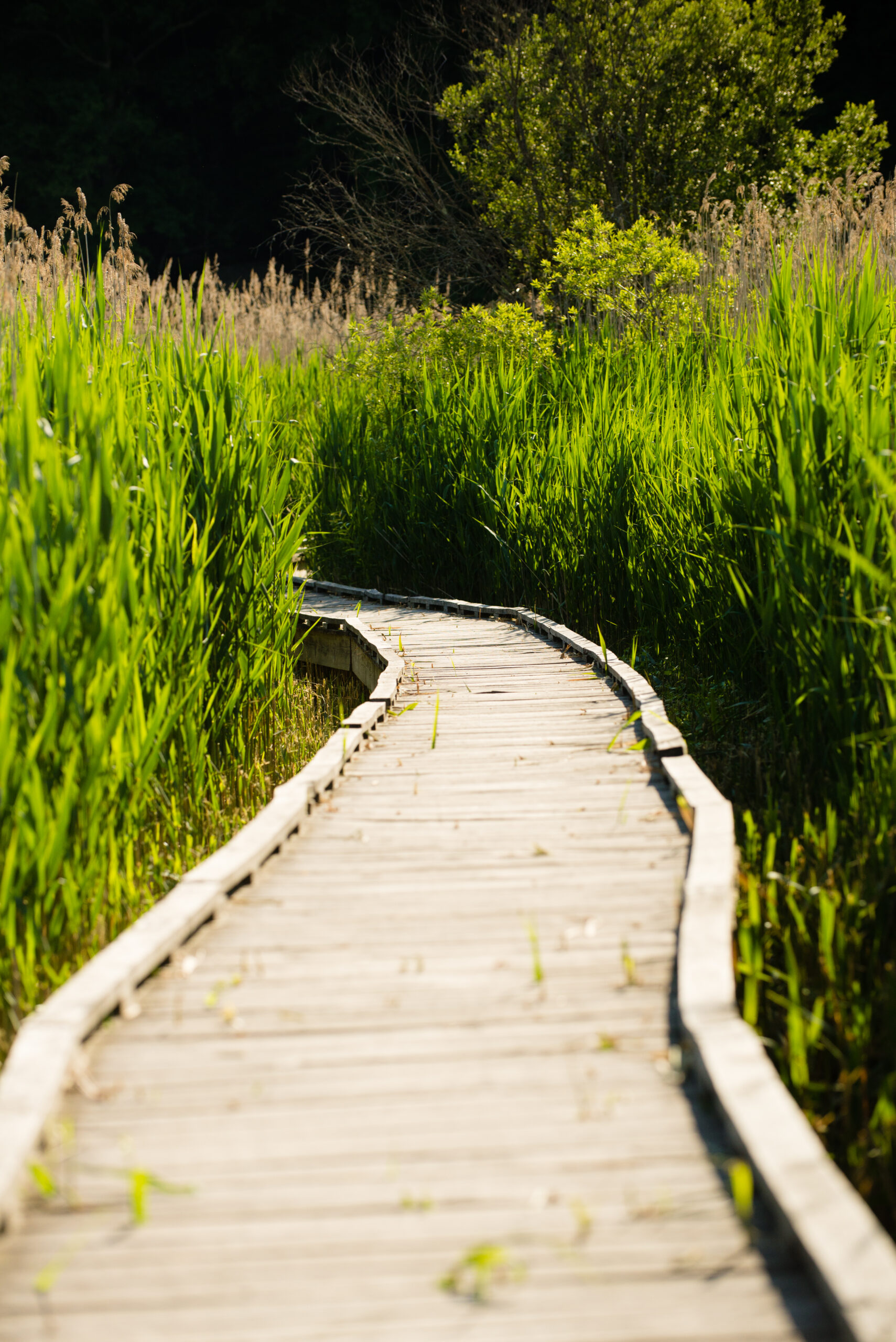
Tidal shorelines and wetlands are distinctive because of daily cycles of flooding and drying, and plants must tolerate these daily changes. Tidal environments in Dutchess County generally are freshwater systems because the dense, deep saltwater moving north from the ocean normally reaches no farther than New Hamburg, although brackish water can reach Poughkeepsie during droughts [8]. Tidal environments are distinguished by variations in depth: subtidal areas remain below the waterline at low tide; the intertidal zone is the range between high and low tide lines, so that it is flooded at high tide and exposed at low tide. Supratidal areas are above the high tide line and are not generally flooded. Tidal zones are also distinguished by the composition of the substrate—generally muddy, sandy, or rocky.
Tidal shorelines occur along the Hudson River and at the mouths of tributary streams, such as at Tivoli Bay, Norrie Point, and New Hamburg. Mud flats may be exposed at low water. Below the low tide line, submerged aquatic vegetation roots in the river bottom, with leaves floating on the surface. In the intertidal zone (which experience both flooded and exposed conditions) vegetation includes cattail, pickerelweed, and other herbaceous plants. Tidal environments support plants and invertebrates that tolerate varying degrees of salinity (where water is brackish), as well as animals and birds that forage in exposed mudflats. A wide range of plants; waterfowl, wading birds, and songbirds feed in the shallow water and low vegetation. Species of conservation concern include the American Bittern, Wood turtle, and Northern leopard frog [9].
Freshwater Wetlands, Non-TidalFreshwater wetlands, streams, and waterbodies comprise approximately 45,650 acres, or about 9% of Dutchess County [10] . These wetlands are widely distributed across Dutchess County, including lowland and level areas, floodplains, and rocky ridge tops. Many of the wetlands in the county are small and scattered about without any discernible pattern. There are concentrations, however, along many of the major waterways, including the Swamp River in the Towns of Pawling and Dover, the Tenmile River in Amenia and North East, and the Fishkill Creek in East Fishkill. The Great Swamp, which extends along the Tenmile and Swamp Rivers from Dover well into Putnam County, is one of the largest and most diverse wetlands in the state.
Wetlands are unique resources at the interface between water and land. Hydrogeologic studies have shown that wetlands are often important regulators and purifiers of surface water and groundwater supplies. Flooded wetlands can, in turn, recharge groundwater supplies or surface waters. Water stored in wetlands helps maintain continuous stream flows during droughts. In addition to these valuable water management functions, wetlands provide food, cover, and breeding grounds for waterfowl and other wildlife. They support unusual plant life and diverse ecological communities, and provide recreational, educational, and aesthetic benefits.
Unlike forests, wetlands have great biological importance when they are small and isolated. Where isolated wetlands lack stream outlets, they are generally inaccessible to fish that would prey on the eggs and young of frogs and salamanders. Thus, isolated and seasonal wetlands provide safe reproductive habitat for amphibians. This type of wetland is often referred to as seasonal wooded wetlands because they typically occur in wooded areas in our region. They may also be called vernal pools because they are most evident in spring. These wetlands can be easy to overlook as they are usually too small to appear on maps, they may be dry in late summer or fall, and their extent varies from year to year. In addition, wetland complexes can consist of scattered water bodies that appear isolated from above but are hydrologically connected below ground. Modification of part of such a complex can lead to unforeseen effects on other parts of the complex.
Historically, wetlands have been regarded as waste lands, useful only if they could be filled or drained for development or agricultural purposes. Because of this attitude, at least half of the wetlands in the lower 48 United States have been destroyed since colonial time [11]. Wetlands are now recognized for the many benefits they provide, including storage of floodwaters, removal of many pollutants, and breeding areas for amphibians and many other animals and plants. As development pressures increase, corresponding pressures to fill, drain, or build in wetlands also increase. Wetlands are not suitable locations for landfills, basements, septic systems, or other structures and uses that function poorly in wet soils or destroy natural wetland functions.
Concern about the destruction of wetland resources led to the passage of the New York State Freshwater Wetlands Act in 1975. This act requires permits for all non-agricultural activities that could change the quality of wetlands 12.4 acres or larger and smaller wetlands of unusual local importance. It also requires the State Department of Environmental Conservation (NYSDEC) to inventory and evaluate the wetlands of the state. Upland areas that drain into wetlands, however, are not necessarily addressed by most wetland protection laws, and development of these areas can alter the depth, water quality, and vegetative community of wetlands. Protection of these upland areas is thus also important.
In 2022, an amendment was made to New York's Freshwater Wetlands Act (Environmental Conservation Law Article 24) which will bring about a number of important changes to how wetlands are managed and protected in the state. As of January 1, 2025, the DEC’s regulatory jurisdiction will no longer be limited to wetlands depicted on the NYS Freshwater Wetland Maps. Instead, these maps will be solely informational, and any wetlands that meet the applicable definition and criteria will be subject to DEC regulation. Also as of January 1, 2025, small wetlands of "unsual importance" will be regulated if they meet one of 11 newly established criteria listed in the legislation. Another important update is that by January 1, 2028, the regulation size threshold for wetlands will decrease from 12.4 acres to 7.4 acres [12].
Table 2. Dutchess County Wetlands (Statistics from National Wetlands Inventory – NWI 2022)| Wetland Type | Acreage |
| Estuarine and Marine Wetland | 44.7 |
| Freshwater Emergent Wetland (Marsh) | 7,985.6 |
| Freshwater Forested/Shrub Wetland (Swamp) | 23,887.7 |
| Freshwater Pond | 4,199.0 |
| Lake | 3,752.4 |
| Riverine | 5,805.4 |


Percentage of Dutchess County wetland acreage by 12.4-acre break
Forests
Forests are wooded areas in which trees are the dominant vegetation type. Forests provide numerous benefits including wildlife habitat, clean water, thermal refuge, carbon sequestration, forest products, and many others. Throughout this section, forests will be defined as wooded areas comprised of trees at least five meters (~15 feet) tall and that occupy more than 20 percent of the land area [13]. Dutchess County has a total of 317,383 acres of forested land. This is an increase of 31,008 acres (+10.8%) from 2000 [14].
Table 3 below shows Dutchess County’s municipalities, ranked in order of most to least percent forested. Note the last two columns which show change in acreage and percent change of forest between the years 2000 and 2017 [14].| Municipality | Forested Acres (2017) | Percent Forested (%) | Change in Forested Acres (2000-2017) | Percent Change in Forested Acres (2000-2017) |
| Dutchess County | 317,383.1 | 60.1 | 31,007.8 | 10.8 |
| Milan | 17,333.0 | 74.1 | 1,221.5 | 5.2 |
| Dover | 26,298.6 | 73.0 | 1,957.1 | 5.4 |
| Pawling (T) | 19,686.4 | 71.1 | 1,265.9 | 4.6 |
| Hyde Park | 16,691.2 | 70.5 | 1,650.4 | 7.0 |
| Fishkill (T) | 11,827.4 | 69.1 | - 2.8 | -0.1 |
| Clinton | 16,981.0 | 68.3 | 1,240.7 | 5.0 |
| Rhinebeck (T) | 14,685.3 | 66.5 | 1,240.3 | 5.6 |
| Pleasant Valley | 13,818.9 | 65.2 | 1,298.5 | 6.1 |
| Beekman | 12,624.7 | 64.4 | 1,563.3 | 8.1 |
| Union Vale | 15,325.0 | 64.1 | 1,718.6 | 7.2 |
| East Fishkill | 23,089.6 | 62.7 | 1,586.2 | 4.3 |
| LaGrange | 15,301.4 | 59.3 | 2,250.0 | 8.7 |
| Stanford | 18,974.9 | 59.2 | 2,440.4 | 7.6 |
| Washington | 21,404.0 | 58.8 | 2,236.2 | 6.1 |
| Wappinger (T) | 9,863.9 | 58.1 | 843.2 | 5.0 |
| Amenia | 16,132.2 | 57.7 | 1,582.3 | 5.7 |
| Red Hook (T) | 11,863.0 | 54.9 | 1,808.4 | 8.3 |
| Pine Plains | 10,812.1 | 54.3 | 1,658.6 | 8.3 |
| Tivoli (V) | 490.0 | 49.8 | 116.8 | 11.9 |
| North East | 13,211.0 | 48.0 | 1,200.9 | 4.4 |
| Poughkeepsie (T) | 8,469.9 | 46.4 | 1,640.1 | 9.0 |
| Rhinebeck (V) | 404.1 | 41.4 | 123.9 | 12.7 |
| Millbrook (V) | 489.7 | 39.7 | 128.6 | 10.5 |
| Beacon (C) | 1,139.1 | 37.6 | 45.3 | 1.4 |
| Pawling (V) | 466.9 | 37.1 | 193.5 | 15.4 |
| Millerton (V) | 132.98 | 34.5 | 63.19 | 16.4 |
| Red Hook (V) | 225.64 | 33.0 | 121.20 | 17.7 |
| Wappingers Falls (V) | 235.20 | 30.7 | 35.50 | 4.6 |
| Poughkeepsie (C) | 993.01 | 30.1 | 346.97 | 10.5 |
| Fishkill (V) | 133.36 | 25.2 | 56.56 | 10.7 |
Large increases in forest cover in many of these municipalities are likely due to conversion of farmland and grassland/shrubland to forest. Dutchess County forests are mostly deciduous, but there are also some significant areas of coniferous and mixed forest.
Deciduous Forest
Deciduous forests (dominated by maples, hickory, oak, ash, birch) occur throughout the county and are the dominant forest type. The 1985 NRI differentiated lower slope, mid-slope, and upper slope deciduous forest. All have forest canopies dominated by the tree families noted above, although proportions vary. Understory vegetation also varies: at low elevations, common species include spice bush, honeysuckle, dogwood, grape, and Virginia creeper; at higher elevations common species include mountain laurel and blueberry.
Deciduous forests grow over much of the county, but notable areas of expansive, unfragmented forest include the Hudson Highlands, the Taconic Highlands, and the Wappinger Creek headwaters area of north-central Dutchess County. Among these forests, wooded wetlands can have particular value for birds, mammals, invertebrates, and specialized plants, as noted above. Much of this forest is second-growth, and 75 years after agriculture it may still retain an understory, soil, and herbaceous characteristics that are still developing toward mature old-growth conditions. Mature deciduous forest may contain a greater richness of spring ephemeral flowers as well as a richer soil microbial community, mushrooms, and other characteristic woodland flora and fauna.
Species of interest for conservation include a variety of spring ephemeral flowers, eastern box turtle, wood frogs, salamanders, woodland warblers, woodpeckers, American turkey, and Indiana bat. Sugar maple, a traditional dominant, is a species of concern because it is widely being displaced by the similar-looking Norway maple. Less common but notable species include the Cooper’s hawk, barred owl, pileated woodpecker, black bear, bobcat, and southern flying squirrel [9].
Coniferous & Mixed Forest
Dutchess County contains some conifer plantations as well as scattered naturally occurring coniferous stands. Plantations consist of more uniform stands of Scotch pine, red pine, European larch, and Norway spruce, while natural stands include eastern hemlock, white pine, and eastern red cedar. Coniferous forests provide important habitat for a variety of mammals, including winter shelter for white-tailed deer. Some species of owls and hawks utilize coniferous forests for roosting and nesting, because the dense foliage provides secure cover year-round. Many songbirds also nest in coniferous forests.
Mixed forests comprise a combination of deciduous and coniferous tree species, where neither type is dominant. White pine, red cedar, and hemlock are common conifers in mixed forest stands, as well as maple, oak, hickory, and other deciduous trees [9][13].
Matrix Forest Blocks & Linkages
The Nature Conservancy (TNC) has identified globally rare matrix forests at the statewide level. These forests are large enough to withstand major natural disturbances, maintain important ecological processes, and support populations of forest-interior wildlife and plants. In partnership with the New York Natural Heritage Program, TNC identified forest linkage zones represent intact natural corridors that connect matrix forests at a regional scale across New York State [15].
By visualizing how natural resources extend beyond political boundaries, counties and municipalities can better understand the context of their decisions at a landscape scale. Furthermore, climate change, habitat fragmentation, and other human disturbance will continue to cause plants and animals to move across the landscape and municipal governments might be able to facilitate this movement through land use planning and decision-making. Whether planning or making decisions at the site or municipal scale, stepping back to understand a site’s ecological context can help guide new development to avoid cumulative impacts to major natural features.
Forest Condition Index & Core Forests
Forests vary in their ability to support native species and withstand or recover from external stressors such as fragmentation, severe storms, and invasive species. The Hudson Valley Forest Condition Index maps and prioritizes forest patches based on a variety of metrics relating to ecosystem health or integrity. Large forest patches in the estuary watershed were first identified through a landscape fragmentation analysis using forested and other woody land cover classes from the 2016 National Land Cover Database. The resulting areas represent continuous patches of forest unfragmented by major roads, railroads, and non-forest habitat, with a minimum patch size of 100 acres. The forest patches were then scored for 22 metrics related to forest condition, connectivity, stress, habitat, and other ecosystem values. These component metrics were summed to create the index and ranked according to percentile of all forest patches in the estuary watershed [16].
Core forests are interior forest areas surrounded by at least a 100-meterwide buffer of edge forest habitat. These interior forest areas support a unique array of plants and animals that are easily disturbed by human activity generally associated with more open habitats. Core forest is especially important for sensitive wildlife including many forest songbirds, which avoid nesting near areas with human disturbance. Although the value of individual forest patches for wildlife depends on landscape context and other factors, core forests that are at least 500 acres in size are more likely to provide enough suitable habitat to support a diversity of interior forest species. Core forests were mapped using the large forest patches identified for the Forest Condition Index, described above. Avoiding further fragmentation of core forests will help conserve the integrity and habitat value of ecologically significant forest patches. By guiding development toward the edges of forest patches, fragmentation of these resources can be limited, and vital benefits can be maintained. The highest quality forests are good candidates for protection or other municipal conservation efforts[16].
High Quality Forests in Dutchess County Two (2) “Top 1%” forest patches:- Southern Taconic Mountains (Town of North East)
- East Mountain (Towns of Dover and Amenia)
- Stissing Mountain and Cold Spring Creek area (Towns of Pine Plains, Stanford, and Milan)
- Ridge east of Wassaic hamlet (Town of Amenia)
- Cobble Mountain area (Towns of Amenia and Dover)
- Taconic-Hereford Multiple Use Area (Towns of Pleasant Valley, Washington, LaGrange, and Union Vale)
- West Mountain (Towns of Dover, Union Vale, Beekman, and Pawling)
- Tenmile Hill (Town of Dover)
- Quaker Hill (Town of Pawling)
- Cranberry Mountain (Town of Pawling)
- Shenandoah Mountain (Town of East Fishkill)
Grasslands & Shrublands
Open habitats in Dutchess County are dominated by grasses and by herbaceous plants (goldenrod, asters), shrubs (blackberry, multiflora rose, juniper, sumac), and scattered early successional trees (red cedar, gray birch, white pine, quaking aspen). These open areas are less abundant than in previous decades, owing to the regrowth of tree cover noted above. These habitats generally include plant types that readily occupy disturbed environments, since many remain open because of haying or grazing. Although grasslands and shrublands are often considered temporary or transitional in our region, they can be of great ecological interest as they support birds, butterflies, fireflies, distinctive grassland plants, and other flora and fauna of interest.
Grasslands
This category includes areas dominated by grassland and other herbaceous species, including hayfields, pasture, and croplands. Habitat values in these areas vary by the type of vegetation present and the type of disturbance to which they are subjected. Infrequently mowed hayfields, for example, may support grassland breeding birds while cultivated croplands may have little habitat value. However, when left undisturbed, pastures, hayfields, and croplands tend to develop similar characteristics as diverse species of grasses, forbs, and shrubs colonize and create habitat for a variety of wildlife species, including invertebrates, reptiles, mammals, and birds [9].
Grasslands represent the most at-risk land cover category within Dutchess County, as there was a decline of over 20% in the acreage of this important habitat between 2011 and 2019. There is currently approximately 3,500 acres of grassland in Dutchess County, down from ~ 4,400 acres in 2011 [17]. The majority of this acreage comes in the form of small, non-contiguous parcels, instead of large tracts of grassland, which is critical for a number of grassland bird and plant species to thrive.
Shrublands
Shrublands are upland areas dominated by woody vegetation less than 5 meters in height [13]. Shrublands represent an intermediate stage of ecological succession, or transition from abandoned fields, pasture, or cropland to forest. Forest is considered the climax ecological community in this region of the country since open areas left undisturbed will eventually develop into mature forests. Typical shrubland plant species include goldenrod, aster, orchard grass, gray dogwood, multiflora rose, black raspberry and many other shrubby species. Some bird species, such as northern mockingbird and American robin, nest in shrublands. Several state and federal-listed birds can be found utilizing shrublands, including northern harrier, golden-winged warbler, and grasshopper sparrow. Many butterflies may be present as well [9].
Shrublands have increased significantly in Dutchess County in the past 10+ years. Between 2011 and 2019, shrubland increased from ~1,650 acres to ~2,900 acres – a gain of ~75% (NLCD). The reason for this large gain is likely due to the abandonment of agricultural fields, allowing previous pasture and grasslands to be converted to shrubland [17].
Significant Natural Communities
A natural community is an assemblage of interacting plant and animal populations that share a common environment; particular assemblages occur across the landscape in areas with similar environmental conditions. In 2018, the New York Natural Heritage Program (NYNHP) worked to map 162 identified and inventoried “significant natural communities” across New York State. The natural communities in this data set include wetlands, forests, grasslands, streams, and other types of habitats, ecosystems, and natural areas. They are considered significant from a statewide perspective because they are rare or high quality based on size, habitat condition, and quality of the surrounding landscape. Significant natural communities may provide habitat for rare plants and animals, support intact ecological processes, and contribute other ecosystem benefits [18].
Twenty-five (25) of these significant natural communities can be found in Dutchess County as listed in the table below. The Tidal (Hudson) River is the largest of these communities, with over 11,000 acres within the county boundary. The largest terrestrial significant natural community within the county is the Appalachian Oak-Hickory Forest community. These specific forests are considered matrix forests, meaning they cover large regions of the state and county and include patches of other natural communities. Appalachian Oak-Hickory Forests are hardwood forests that typically occur on well-drained sites, usually on ridgetops, upper slopes, or south- and west-facing slopes and usually on loam or sandy loam soils. This is a broadly defined forest community and can vary widely by location within the state. Within Dutchess County, the dominant trees include one or more species of oak (e.g. white, red, black oak) and/or one or more species of hickory (e.g. shagbark, bitternut, pignut hickory). Dogwood and viburnum species are common understory shrubs, along with a diverse mix of sedges, wildflowers, and other herbaceous plants on the forest floor [18].
| Natural Community | Area (acres) |
| Tidal River | 11,033 |
| Appalachian Oak-Hickory Forest | 3,948 |
| Chestnut Oak Forest | 2,136 |
| Oak-Tulip Tree Forest | 1,574 |
| Floodplain Forest | 1,370 |
| Hemlock-Northern Hardwood Forest | 1,367 |
| Red Maple-Hardwood Swamp | 854 |
| Freshwater Tidal Marsh | 463 |
| Acidic Talus Slope Woodland | 262 |
| Red Cedar Rocky Summit | 232 |
| Freshwater Intertidal Mudflats | 197 |
| Pitch Pine-Oak-Heath Rocky Summit | 156 |
| Rocky Summit Grassland | 92 |
| Freshwater Tidal Swamp | 71 |
| Deep Emergent Marsh | 60 |
| Maple-Basswood Rich Mesic Forest | 58 |
| Brackish Tidal Marsh | 15 |
| Brackish Intertidal Mudflats | 10 |
| Freshwater Intertidal Shore | 9 |
| Limestone Woodland | 6 |
| Vernal Pool | 6 |
| Medium Fen | 4 |
| Calcareous Red Cedar Barrens | 3 |
| Dwarf Shrub Bog | 2 |
| Calcareous Cliff Community | 1 |
There are a number of significant natural communities that have only a single occurrence and low acreage in Dutchess County: Calcareous Cliff Community, Dwarf Shrub Bog, Calcareous Red Cedar Barrens, Medium Fen, Limestone Woodland, Brackish Intertidal Mudflats, and Brackish Tidal Marsh. The Calcareous Red Cedar Barrens community is particularly noteworthy as the only occurrence within New York State is found in Dutchess County (the Nellie Hill Preserve in the Town of Dover). These less common natural communities host their own unique flora and fauna (and in many cases soils & geology) and add to the overall biodiversity of Dutchess County.
Conservation and management guidance for significant natural communities is available through the NYNHP online conservation guides.
Conservation Priorities
A first step toward identifying areas of importance for conserving biodiversity is to identify target habitats, or habitats likely to be of value in the Hudson Valley region (Table 5). In addition to these general environments, specific habitats, such as acid bogs, talus slopes, or tidal marshes can shelter rare species. Examples of these habitats (and threatened or vulnerable species that may occur) include fens and calcareous wet meadows (Bog Turtle, Glyptemys muhlenbergii), kettle shrub pools (Blanding’s turtles, Emydoidea blandingii), and cliff habitats (Ram’s head ladyslipper, Cypripedium arietinum). Characteristics of these habitat types have been documented by the NY Natural Heritage Program and by Hudsonia [3][9].
The importance of biodiversity for its own sake has been acknowledged in the formation of legal codes that protect species and their habitat. There are legal protections for rare, threatened, and endangered, and migratory species, in efforts to minimize threats to biodiversity. Agencies that administer these regulations usually also provide assistance to landowners. Because landowner participation is so important in conservation, the US Fish and Wildlife Service and other agencies are charged with helping landowners design conservation plans, devise plans for development that maximize habitat conservation, and provide grants for assistance in habitat conservation.
Familiarity with regional species and habitats of concern will aid in identifying priority areas in your community. While conserving priority areas is important, it’s also crucial to maintain an overall abundance of common habitats, for “keeping common species common.” Maps (including those in this natural resources inventory) can aid in identifying local resources. Two key resource include the aforementioned New York Natural Heritage Program (NYNHP) and Hudsonia, which collectively have mapped biologically important areas for the region. Biologists at both organizations can aid communities in prioritizing species and areas for conservation. Communities can also consult with other municipalities in the area that have completed biodiversity conservation plans and natural resource inventories. To identify these municipalities, local groups should consult with Dutchess County Planning, Cornell Cooperative Extension Dutchess County, and the NYSDEC.
Table 5. Top Conservation Priorities for Dutchess County [1]
Habitat | Species requiring habitat |
Shoreline corridors* | river otter, wood turtle, cerulean warbler, wading birds, trout, stream salamanders and Hudson River water nymph |
Unfragmented forests | scarlet tanager, warblers, wide-ranging mammals, hawks, owls, box turtles, and plants like fringed polygala flower |
Grasslands and shrublands | northern harrier, bobolink, eastern meadowlark, golden-winged warbler, short-eared owl, and uncommon butterflies |
Wetlands | American bittern, marsh wren, Blanding’s turtle, northern leopard frog and a rich diversity of flora like pitcher plant |
Seasonal woodland pools | Jefferson, marbled, and spotted salamanders, wood frog, spotted turtle, fairy shrimp, and others declining throughout the Northeast |
Caves and cliff habitats | bats, peregrine falcon, overwintering snakes, migrating hawks, and rare cliff plants like purple cliffbrake and prickly pear |
Unique natural areas | at-risk plants and animals |
* Includes Hudson River shoreline, streams, intermittent streams
Threats to Biodiversity
Habitat Fragmentation
Habitat fragmentation is one of the largest and most conspicuous threats to biodiversity. Habitat fragmentation refers to the physical disruption of intact plant and animal habitats by development, buildings, roads, and/or right of ways. Fragmented habitats act as an impediment for wildlife of all kinds as they cause disturbances to their feeding and movement patterns and have the potential to exacerbate the spread of invasive species that affect both nature and humans (e.g. black-legged ticks that can spread diseases such as Lyme, Powassan, or babesiosis, and the invasive emerald ash borer that is now devastating our region’s ash trees). Developing in sustainable ways that limit the extent of habitat fragmentation is a great way to help maintain the biodiversity of our communities.
Forests
Large, intact forests provide habitat for breeding birds and mammals and act as a “sink” for carbon dioxide in our atmosphere. These sinks act as repositories for elemental carbon and are important for mitigating the amount of carbon dioxide, a greenhouse gas, in our atmosphere. Forests have the ability to remove carbon dioxide through their leaves and store it in their biomass and in the soil, and intact forests store more carbon than ecologically-similar forests that have been disturbed by logging or development and degraded by erosion. Large intact forests also promote increased biodiversity as a greater number of forest-dependent species are found in intact ecosystems than in degraded ones. Larger habitats allow for natural disturbance regimes to take place and provide increased diversity within and between species [19].
Forest habitats of varying sizes provide different benefits in regard to biodiversity. Small contiguous patches of forest allow for some diversity within small mammal and less-sensitive bird species populations, however larger contiguous forest patches (2,000 acres or greater) are beneficial for a wider range of biodiversity such as forest-dependent birds and mammals (Table 1) [20]. Riparian and wetland areas also benefit from buffering and remaining unfragmented. Buffers of 100-200 feet help to protect water resources and core aquatic habitat for fish and macroinvertebrates, whereas larger buffers of 500-1,000 feet help to protect core riparian habitat for reptiles, amphibians, and other vernal pool-dependent species [21].
Table 6: Forest Sizes for Effective Conservation (adapted from Conserving Natural Areas and Wildlife in Your Community. Strong, et al., 2008)
| Size in Acres | Species | Notes |
| 5 | Small mammal diversity to reduce Lyme disease risk (Allan et al. 2003) | Minimum size to represent a particular plant community (Kennedy et al. 2003) |
| 200-2,000 | Some less-sensitive forest interior birds | Broad corridors provide important connections to larger forests; edge habitats and species will dominate |
| 2,000-5,999 | Minimum area needed for sensitive forest dependent birds | Provide important corridors and connections among larger forests |
| 6,000-14,999 | Some area-sensitive species | Can accommodate some largescale disturbance, but may not be able to maintain entire range of habitats after large-scale disturbance |
| 15,000+ | Wide-ranging and area sensitive species, including broad-winged hawk, barred owl, neotropical migrants, bear, and bobcat | Contain a wide range of forest successional stages; can accommodate large-scale disturbances like blowdowns and fire |
Loss of biodiversity as a result of forest and other habitat fragmentation can pose a threat to the native biological communities and can increase the risk to human health through the spread of diseases such as Lyme disease or other tick-borne diseases. It is estimated that there are 240,000 to 440,000 cases of the tick-borne illness each year nationwide and that Lyme disease alone costs between $712 million and $1.3 billion a year in health care [22].
In a collaborative study between researchers from the Cary Institute of Ecosystem Studies, Bard College, and Rutgers University, it was found that forest fragmentation leads to a reduction in mammalian diversity and an increase in population densities of white-footed mice, one of the most common carriers of Lyme disease [23]. The vector for the spread of Lyme disease (among others) is the black-legged tick, which thrive in small, fragmented forests. Furthermore, high white-tailed deer densities in Dutchess County and the Hudson Valley region exacerbate the problem two-fold: 1) white-tailed deer often carry and disperse ticks and 2) high deer densities lead to poor native plant regeneration as deer favor the young saplings of native trees and shrubs over invasive plants [24]. As a result, forest understories have the potential to become choked out by these non-native species (e.g. Japanese barberry, multiflora rose, etc.) which provide further shelter for mice and other small mammals, creating a positive feedback loop [25].
Invasive Species
Another threat to biodiversity is the continued spread of invasive species. While invasive pests pose a major challenge to native biota all throughout the country, the Northeast and New York State is at the epicenter being a major hub for shipping and transportation – two of the main modes of dispersal for invasive species [26]. In New York, Dutchess County is tied for third in the state for number of damaging invasive forest pests at 40 species, behind only Suffolk County with 42 species and Ulster County with 41 species [27] (adapted from data from Liebhold, et al., 2013). The impacts of invasive pests vary species to species, but in most cases these insects, plants, and animals directly harm or indirectly outcompete our native fauna, flora and agricultural crops (Table 7). Managing for invasives requires planning with regards to proper forest management, laws and ordinances on transportation of firewood or quarantined species, and appropriate active management of current infestations.
Table 7: Some common invasive species found in Dutchess County
| Species | Type | Impact |
| Emerald ash borer (EAB) | Insect | Infests ash trees |
| Asian long-horned beetle (ALB) | Insect | Infests hardwood trees (maple, birch, elm, ash, poplar, horse chestnut, and willow) |
| Hemlock woolly adelgid (HWA) | Insect | Infests eastern hemlock trees |
| Gypsy moth | Insect | Infests various hardwoods and softwoods |
| Spotted Lanternfly | Insect | Infests fruit trees and agricultural crops |
| Japanese barberry | Plant | Outcompetes native understory shrubs |
| Japanese stilt grass | Plant | Outcompetes native grasses |
| Oriental bittersweet | Plant | Climbs, strangles, and outcompetes native trees |
| Black swallow-wort | Plant | Climbs, strangles, and outcompetes native shrubs and grasses |
| Mute swan | Animal | Harasses and outcompetes native waterfowl |
| European starling | Animal | Brood-parasitizes and outcompetes native songbirds |
| Asian carp | Animal | Outcompetes native fish species |
Alteration of Wetlands & Riparian Areas
Wetland loss is another major threat to our local biodiversity. While New York State regulates and protects wetlands that are 12.4 acres (5 hectares) or larger, small unmapped and unregulated wetlands can be at risk from development. These smaller wetlands play an equally important role in flood mitigation, water quality improvement, and habitat for rare amphibian and reptile species. A 2000 study published in Conservation Biology found that protections for all wetlands >1 acre (0.4 hectare) are likely required to maintain wetland densities that are minimally sufficient to sustain the flora and fauna dependent on wetlands and the services that these wetlands provide [28].
Unsustainable Development & Land Use
Dutchess County, as with the Hudson Valley region as a whole, is an area of diverse land use and land cover. From the urban centers of Poughkeepsie and Beacon to the forested mountains of the Taconics and Hudson Highlands, and the wealth of farmland and wetlands in between, Dutchess County’s varied terrain and land cover has led to equally diverse usage of that land over time.
Dutchess County’s population has grown steadily since European settlement, with the most notable increases in the 1950s and 1960s. This change resulted in historical clearing for farmland, some of which has since been abandoned and allowed to revert back to shrub and forest land.
An important recent trend in land use has been dominated by expanding developed land, in particular housing, commercial, and transportation activities. From 2011 to 2019, ‘medium intensity’ development and ‘high intensity’ development increased by 4.7% and 8.2%, respectively. Whereas ‘high intensity’ development is typically focused around urban, commercial, and industrial areas, ‘medium intensity’ development most often occurs away from urban centers, as residents increasingly want, and can afford, large lot sizes, larger houses, and longer commutes to work. In the past 10-20 years, roughly one-third of new houses have been built on lots 2 acres or larger—a dramatic transition from the 1960s and 1970s. A main implication of this change includes a greater fragmentation of habitat.
Another trend of note is the continued loss of grasslands/meadows throughout the county. From 2011 to 2019, Dutchess County saw a 20% decrease in this land cover type (NLCD category ‘Herbaceous’), likely due to conversion of these areas to suburban development and/or conversion to ‘shrub/scrub’ as fields are neglected and allowed to succeed, or transition, into woodier habitats [31].
Pollutants & Water Contamination
The rich hydrology of Dutchess County has historically provided adequate water to meet community needs. However, human interactions with the land introduce threats to all of the county’s water resources through changes in surface water runoff, the reduction of groundwater infiltration, water contamination, and soil erosion. In many ways, climate change is exacerbating these threats and creating new stresses.
Surface Water
As human demands for water increase or groundwater recharge decreases, there is the potential for inadequate flow of water in streams during dry periods. Low flows can lead to high water temperatures, inadequate dissolved oxygen levels, and restrictions on movements of fish and other aquatic organisms. Efforts to establish minimal environmental flows have developed procedures to determine how much water must be left in a channel to ensure good habitat value and ecological functioning.
Groundwater
Non-point source contaminant sources pose a new challenge to communities and regulators. Where wells and septic systems are in use, well water quality can suffer if not buffered by adequate recharge. The recharge rates presented in Dutchess County Aquifer Recharge Rates & Sustainable Septic System Density study have been used to recommend minimum average parcel sizes for homes using individual wells and septic systems. Analysis of the 250 domestic well water samples discussed above suggests that nitrate concentrations detected in groundwater wells show a greater incidence of higher levels when near clusters of septic systems.
Sodium and chloride concentrations recorded in the 250 domestic well samples also can be higher more often; mostly likely due to the proximity of the parcels to roads. USGS analysis of sewered and unsewered watersheds in Putnam and Westchester Counties verified that there were few differences in sodium chloride concentrations in groundwater between watersheds with or without septic systems, suggesting that road salt rather than water softener discharges to septic systems are the dominant source of salt in groundwater.
Dutchess County’s aquifers are vulnerable to contamination from sources other than septic systems and roads, including a host of regulated and some remaining unregulated land-use practices. Traditional sources of recognized groundwater contamination such as landfills, leaking petroleum or chemical storage tanks, both accidental and intentional illegal discharges, and heavy uses of fertilizers continue to contribute to the risk of aquifer contamination.
Other sanitary waste components such as pharmaceutical residues and personal care chemicals may also be present in groundwater near septic systems. Recommended parcel sizes, based on hydrologic soil group and aquifer recharge ensure a greater measure of dilution of such discharges from surrounding unimpacted groundwater but desirable contaminant dilution ratios have not been developed since no human health or aquatic health standards are available.
Many cases of groundwater pollution have appeared in recent years. The most common pollutants fall into distinct categories:
- road de-icing salts (sodium chloride) particularly at bottoms of hills or ends of cul-de-sacs where salt residues can accumulate as a result of heavy application or plowing or within settlement areas where road networks are particularly dense
- organic solvents (trichloroethylene, perchloroethylene, or carbon tetrachloride) from illegal dump sites, industrial sites, and sometimes from household products
- fertilizers
- petroleum products (gasoline and heating fuel) from spills, leaking tanks, and pavement runoff
- septic system discharges
Wetlands
As development pressures increase, corresponding pressures to fill, drain, or build in wetlands also increase. Wetlands are not suitable locations for landfills, basements, septic systems, or other structures and uses that function poorly in wet soils or destroy natural wetland functions.
Concern about the destruction of wetland resources led to the passage of the New York State Freshwater Wetlands Act in 1975. This act requires permits for all non-agricultural activities that could change the quality of wetlands 12.4 acres or larger and smaller wetlands of unusual local importance. It also requires the State Department of Environmental Conservation to inventory and evaluate the wetlands of the state. The act applies to 4.4 percent of Dutchess County and approximately 70 percent of the county’s total wetland acreage.
Climate Change
Warming winters, longer summers, and possibly deeper droughts in summer are already having important impacts on biological communities in our area. Impacts on biodiversity are likely to involve northward shifts in
populations of vegetation, animals, and diseases or parasites that affect wildlife or plants, as well as increased prevalence of invasive species. In many areas of New York, including Dutchess County, cold winters previously prevented the survival of many invasive species, which can cause dramatic shifts in habitat and biotic communities. Examples include deer ticks and tick-borne diseases, or the wooly adelgid, an aphid-like insect that has depleted hemlock stands in warm climates. Forest composition is also expected to change considerably as a consequence of climate change.
Changes to Dutchess County’s climate will be more extreme if human greenhouse gas emissions (GHGs) continue unabated or increase into the future. Climate change will have far-reaching effects on many sectors. New York State, Dutchess County, and other organizations and businesses around New York have begun ongoing efforts to mitigate climate change, or to reduce their emissions of GHGs.
Even with efforts to reduce emissions, adaptation to climate change impacts is necessary now and for the future. Planning for these changes that will occur and considering the future risks of climate change will be critical for decision makers. Those involved in agriculture, insurance, transportation and many other sectors must be cognizant of the latest climate change information and future projections. Reducing our vulnerability to climate change will require changes to our economy and infrastructure, as well as individual attitudes, societal values, and government policies to ensure the stability of both human and natural systems.
Additional Resources
References
[1] Strong, K. Conserving Natural Areas and Wildlife in Your Community: Smart Growth Strategies for Protecting the Biological Diversity of New York’s Hudson River Valley. Ithaca, NY: New York Cooperative Fish and Wildlife Research Unit, Cornell University, and New York State Department of Environmental Conservation, Hudson River Estuary Program, 2008.
[2] United Nations Convention on Biological Diversity. Rio de Janeiro, Argentina: 1992. http://www.cbd.int/
[3] New York Natural Heritage Program. https://www.nynhp.org/
[4] Dutchess County Centers & Greenspaces. https://www.dutchessny.gov/Departments/Planning/Centers-Greenspaces.htm
[5] Dutchess County Greenway Compact. https://hudsongreenway.ny.gov/system/files/documents/2018/05/dutchess-compact-2004-2014.pdf
[6] Hudson Valley Significant Biodiversity Areas. https://www.dec.ny.gov/docs/remediation_hudson_pdf/hrebcf.pdf
[7] New York State Energy Research and Development Authority. Climate Change in New York State – Updating the 2011 ClimAID Climate Risk Information Supplement to NYSERDA Report 11-18 (Responding to Climate Change in New York State). Final Report September 2014. ISBN: 978-1-936842-08-7
[8] United States Geological Survey. Hudson River Salt-Front Data. https://ny.water.usgs.gov/projects/dialer_plots/saltfront.html
[9] Kiviat, E. and G. Stevens. Biodiversity Assessment Manual for the Hudson River Estuary Corridor. Red Hook, NY: Hudsonia Inc., 2001.
[10] United States Fish and Wildlife Service. National Wetlands Inventory. Washington D.C. 2023
[11] Mitsch, J.G. and J.G. Gosselink. Wetlands. New York: Van Nostrand Reinhold, 1993.
[12] New York State Department of Environmental Conservation. Amendments to New York’s Freshwater Wetlands Act (Environmental Conservation Law Article 24). 2022.
[13] National Oceanic and Atmospheric Administration Coastal Services Center (NOAACSC). C-CAP zone 64 2006-Era Land Cover Metadata. Charleston, SC.: 2007.
[14] Dutchess County Office of Central and Information Services (OCIS). Forests. Poughkeepsie, NY. 2017.
[15] The Nature Conservancy, Eastern Conservation Science. Matrix Forest Blocks. The Nature Conservancy Eastern Regional Office. Boston, MA. 2007.
[16] Conley, A. K., E. Cheadle, and T. G. Howard. Updating Forest Patches and a Patch Assessment for the Hudson Valley. New York Natural Heritage Program, State University of New York College of Environmental Science and Forestry, 2019, Albany, NY. www.nynhp.org/forest-patches
[17] United States Geological Survey. National Land Cover Database (NLCD) 2011 & 2019 Land Cover Conterminous United States. Sioux Falls, SD. 2013 & 2021.
[18] New York Natural Heritage Program. Significant Natural Communities/Ecological Communities. 2018.
[19] Watson, J. E. M., et al. The exceptional value of intact forest ecosystems. Nature Ecology and Evolution, 2, 599–610. 2018. https://doi.org/10.1038/s41559-018-0490-x
[20] Strong, K. Conserving Natural Areas and Wildlife in Your Community: Smart Growth Strategies for Protecting the Biological Diversity of New York’s Hudson River Valley. New York Cooperative Fish and Wildlife Research Unit, Cornell University, and New York State Department of Environmental Conservation, Hudson River Estuary Program. Ithaca, N.Y. 2018
[21] Semlitsch, R.D. and Bodie, J.R. Biological Criteria for Buffer Zones around Wetlands and Riparian Habitats for Amphibians and Reptiles. Conservation Biology, 17: 1219-1228. 2018. https://doi.org/10.1046/j.1523-1739.2003.02177.x
[22] Adrion ER, Aucott J, Lemke KW, Weiner JP. Health care costs, utilization and patterns of care following Lyme disease. PLoS One. 2015.
[23] Allan, B.F., Keesing, F. and Ostfeld, R.S. Effect of Forest Fragmentation on Lyme Disease Risk. Conservation Biology, 17: 267-272. 2003. https://doi.org/10.1046/j.1523-1739.2003.01260.x
[24] Horsley, S.B., Stout, S.L. and deCalesta, D.S. White-tailed Deer Impact on the Vegetation Dynamics of a Northern Hardwood Forest. Ecological Applications, 13: 98-118. 2003. https://doi.org/10.1890/1051-0761(2003)013[0098:WTDIOT]2.0.CO;2
[25] Tiffany M. Knight, et al. Deer Facilitate Invasive Plant Success in a Pennsylvania Forest Understory. Natural Areas Journal, 29(2), 110-116, 2009.
[26] Levine, J.M. and D’Antonio, C.M. Forecasting Biological Invasions with Increasing International Trade. Conservation Biology, 17: 322-326. 2003. https://doi.org/10.1046/j.1523-1739.2003.02038.x
[27] Liebhold AM, et al. A highly aggregated geographical distribution of forest pest invasions in the USA. Diversity and Distributions. 19:1208–1216. 2013.
[28] Gibbs, J.P. Wetlands Loss and Biodiversity Conservation. Conservation Biology, 14, 314-317. 2000. https://doi.org/10.1046/j.1523-1739.2000.98608.x
[29] New York State. “Climate Act.” Accessed 2023
[30] New York State Regional Economic Development Councils. “Dutchess County Climate Action Planning Institute (CAPI).” Accessed 2023.
[31] Dewitz, J., and U.S. Geological Survey, 2021, National Land Cover Database (NLCD) 2019 Products (ver. 2.0, June 2021): U.S. Geological Survey data release.
Glossary
Anadromous: Referring to the movement of organisms into rivers (from saltwater to freshwater) for spawning/breeding
Biodiversity: The variety and variability of life on Earth. Biodiversity is a measure of variation at the genetic, species, and ecosystem level
Brackish: Water occurring in a natural environment that has more salinity than freshwater, but not as much as seawater
Calcareous: Geology that contains calcium carbonate (e.g. limestone, calcite, chalk) or referring to vegetation growing on this type of geology
Carbon Sequestration: The process of storing carbon in a carbon pool or sink (i.e. removing carbon dioxide from the atmosphere and storing it in vegetation or soil as other compounds)
Community (ecological): A group or association of populations of two or more different species occupying the same geographical area at the same time
Ecosystem: All the organisms and the physical environment with which they interact, including biotic and abiotic (inorganic) components, nutrient cycling, and energy flows
Ecosystem Services: The many and varied benefits to humans and the biotic world provided by the natural environment and healthy ecosystems
Endemic: Referring to a species found in a single defined geographic location, such as an island, state, nation, country or other defined zone
Estuary/Estuarine: A partially enclosed coastal body of brackish water with one or more rivers or streams flowing into it, and with a free connection to the open sea
Floodplain Forest: A bottomland, deciduous or deciduous-conifer forest community occupying low-lying areas adjacent to streams and rivers, and subject to periodic over-the-bank flooding and cycles of erosion and deposition
Green Space: Community space consisting of land (such as parks or open, protected areas) rather than buildings
Habitat: The array of resources, physical and biotic factors that are present in an area, such as to support the survival and reproduction of a particular species
Matrix Forest: Large contiguous areas forests whose size and natural condition allow for the maintenance of ecological processes and viable forest communities and species populations
pH: A numeric scale (1 to 14) used to measure how acidic/basic water a compound (typically water) is. Lower pH (< 7) means the compound is acidic. Higher pH (> 7) means a compound is basic (or “alkaline”). A pH of 7 is neutral.
Population: A subset of individuals of one species that occupies a particular geographic area and is capable of interbreeding
Riparian: Referring to the zone and/or plant habitats and communities that exist along the banks or margins of a river
Wetland: A distinct ecosystem that is flooded or saturated by water, either permanently or seasonally. Wetlands are typically defined or delineated by the plant communities that thrive there as well as the soil type (“hydric” soils).